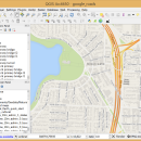
QGIS for Mac 3.36.1 freeware

QGIS supports vector, raster, and database formats and lets you browse and create map data on your computer.
QGIS supports many common spatial data formats (e.g. ESRI ShapeFile, geotiff). QGIS supports plugins ... The initial goal was to provide a GIS data viewer. ...

Author Gary Sherman
Released 2024-03-26
Filesize 1600.00 MB
Downloads 695
OS Mac OS X
Installation Instal And Uninstall
Keywords geographic information system, map creator, map viewer, GIS, geographic information, create, QGIS for Mac
Users' rating
(22 rating)
QGIS for MacCADMac OS X
QGIS for Mac - data on map Freeware Download Notice

QGIS for Mac Free Download - we do not host any QGIS for Mac torrent files or links of QGIS for Mac on rapidshare.com, depositfiles.com, megaupload.com etc. All QGIS for Mac download links are direct QGIS for Mac download from publisher site or their selected mirrors.

QGIS for Mac freeware - The Latest User Reviews
QGIS for Mac freeware - The Latest Versions History
3.36.1 Mar 26, 2024 New Release
3.34.4 Feb 28, 2024 New Release
3.34.3 Jan 22, 2024 New Release

Most popular CAD freeware downloads

Panoply for Mac

5.3.4 freeware download

... plots geo-gridded arrays from netCDF, HDF and GRIB datasets. Panoply is designed to help you view and process the data included in netCDF, HDF, GRIB, and other types ...

TNTmips for Mac OS X

20240111 freeware download

... you work with virtually any type of geospatial data including imagery, terrain surfaces, and map data with associated database attributes. It provides all the tools you need ...

QGIS for Mac

3.36.1 freeware download

... Software (FOSS). QGIS supports vector, raster, and database formats and lets you browse and create map data on your computer. QGIS supports many common ...

QGIS for Linux

3.36.1 freeware download

... Software (FOSS). QGIS supports vector, raster, and database formats and lets you browse and create map data on your computer. QGIS supports many common ...

TNTmips

20240404 freeware download

... you work with virtually any type of geospatial data including imagery, terrain surfaces, and map data with associated database attributes. It provides all the tools you need ...

QGIS

3.36.1 freeware download

... Software (FOSS). QGIS supports vector, raster, and database formats and lets you browse and create map data on your computer. QGIS supports many common ...

Panoply

5.3.4 freeware download

... plots geo-gridded arrays from netCDF, HDF and GRIB datasets. Panoply is a cross-platform software application whose purpose ... created with NetCDF, HDF, GEMPACK, GRIB and other datasets, and combine or slice geo-gridded and other types ...

Elshayal Smart

23.02 freeware download

... remove layers, swap layers, save layer, set layer data source, layer properties, zoom in & zoom out, pan, identify, selecting features, invert selection, show data table, data query builder, location query builder, build ...

GeoMapApp

3.7.1 freeware download

GeoMapApp is a map-based application for browsing, visualizing and analyzing a diverse suite of curated global and regional geoscience data sets. These cover geophysics, geology, geochemistry, physical oceanography, ...

CueMol

2.2.3.442 freeware download

... (CCP4, CNS , and BRIX format), MSMS surface data, and GRASP electrostatic potential map. ...