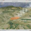
Virtual Terrain Project for Mac OS X and Linux 1.1 110804 freeware

The goal of VTP is to foster the creation of tools for easily constructing any part of the real world in interactive, 3D digital form.

This goal will require a synergetic convergence of the fields of CAD, GIS, visual simulation, surveying and remote sensing. VTP gathers information and tracks progress in areas such as procedural scene construction, feature extraction, and rendering algorithms. ...

Author Ben Discoe
Released 2011-09-08
Filesize 2.20 MB
Downloads 434
OS Linux, Mac OS X
Installation Instal And Uninstall
Keywords libraries, demos, data, open source, VirtualTerrain Project, CAD, GIS, VTP
Users' rating
(22 rating)
Virtual Terrain Project for Mac OS X and LinuxCADLinux, Mac OS X
Virtual Terrain Project for Mac OS X and Linux - data Freeware Download Notice

Virtual Terrain Project for Mac OS X and Linux Free Download - we do not host any Virtual Terrain Project for Mac OS X and Linux torrent files or links of Virtual Terrain Project for Mac OS X and Linux on rapidshare.com, depositfiles.com, megaupload.com etc. All Virtual Terrain Project for Mac OS X and Linux download links are direct Virtual Terrain Project for Mac OS X and Linux download from publisher site or their selected mirrors.

Virtual Terrain Project for Mac OS X and Linux freeware - The Latest User Reviews
Virtual Terrain Project for Mac OS X and Linux freeware - The Latest Versions History
1.1 110804 Sep 8, 2011 New Release Enviro:
Exposed support for more stereo modes: Horizontal and Vertical split.
Options to enable joystick and spacenavigator, rather than just always using them if present.
Smooth continuous update when making buildings.
Option to constrain building point to right angles. Deter user from making bad points.
Made support for Collada (.dae) more explicit in the UI.
Display the version number in the startup dialog.
Added 'every N meters' option to Contour dialog, making it significantly more useful.
Changed 'Move' mode to use Alt modifier key for up/down, to be consistent.
Fixed issues with: support for elevation grids with non-unit vertical scale; removing layers from a terrain; saving snapshot and high-resolution snapshot; buildings with a Geographic CRS; draping of 2D polylines on terrain with vertical exaggeration.

VTBuilder:
Raw layers: Draw polygon holes as dotted lines to tell them from outer edges.

Most popular CAD freeware downloads

RADlab

1.03 freeware download

... [1] for these detectors one needs the cross-section data to sample gamma and neutron interactions. So the cross-section data from XCOM [2] is used for gamma interacting ...

Panoply for Mac

5.4.3 freeware download

... plots geo-gridded arrays from netCDF, HDF and GRIB datasets. Panoply is designed to help you view and process the data included in netCDF, HDF, GRIB, and other types ...

GProX

1.1.16 freeware download

The Graphical Proteomics Data Explorer (GProX) is a freely available complete software ... and integrated analysis and visualization of large proteomics datasets. The program provides a range of functions for ...

Myrtle

1.9.0 freeware download

... important relationships among particular rows or columns of data. Bookmarking also prevents much of the frustration students feel when building cell formulas when the data set is large or when multiple sheet tabs ...

CiDess

4.28 freeware download

... files - You can include comments and extra data in a PCB file - Automatic web page generation to publish your PCB - Support both ...

Cytoscape for Mac OS X

3.10.0 freeware download

... with annotations, gene expression profiles and other state data. Although Cytoscape was originally designed for biological research, ... distribution provides a basic set of features for data integration and visualization. Additional features are available as ...

PyRx

0.8 freeware download

... in every step of this process - from data preparation to job submission and analysis of the results. While it is true that ...

DipTrace Free

4.3.0.0 freeware download

... complex high-density boards with differential pairs and high-speed data buses and get a working prototype on time. ... is available. Our advanced BOM generation tool integrates data from Octopart, including prices and availability, which facilitates ...

Gwyddion

2.66 freeware download

... a modular program for SPM (scanning probe microscopy) data visualization and analysis. Primarily it is intended for ... image analysis, for instance for analysis of profilometry data (learn more about Gwyddion features). Gwyddion is ...

TNTatlas

2024 B20240606 freeware download

... you publish and distribute your maps and geospatial data — from a single geodata file to complex ... rapidly assemble and distribute existing electronic map and database materials for those working in natural disaster relief, ...