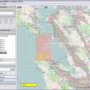
Mobile Atlas Creator 2.2.1 freeware

Mobile Atlas Creator is a small, simple, Java based application specially designed to help you create atlases for TrekBuddy. Basically this software will create offline atlases for GPS handhelds and cell phone applications like TrekBuddy, AndNav and other Android and WindowsCE based applications. ...

Author Fredrik Moller
Released 2021-06-02
Filesize 15.00 MB
Downloads 2224
OS Windows XP, Windows Vista, Windows Vista x64, Windows 7, Windows 7 x64, Windows 8, Windows 8 x64, Windows 10, Windows 10 x64, Linux
Installation Instal And Uninstall
Keywords create atlas, generate atlas, atlas creator, generator, generate, create
Users' rating
(23 rating)
Mobile Atlas CreatorCADWindows XP, Windows Vista, Windows Vista x64, Windows 7, Windows 7 x64, Windows 8, Windows 8 x64, Windows 10, Windows 10 x64, Linux
Mobile Atlas Creator - earth Freeware Download Notice

Mobile Atlas Creator Free Download - we do not host any Mobile Atlas Creator torrent files or links of Mobile Atlas Creator on rapidshare.com, depositfiles.com, megaupload.com etc. All Mobile Atlas Creator download links are direct Mobile Atlas Creator download from publisher site or their selected mirrors.

Mobile Atlas Creator freeware - The Latest User Reviews
Mobile Atlas Creator freeware - The Latest Versions History
2.2.1 Jun 2, 2021 New Release
2.1.3 Rev 24 Apr 14, 2020 New Release Minimum supported Java version increased to Java 8 (1.8)
"mapFile must not be null" error when creating an atlas
Save settings to settings.xml in UTF-8 format (fix for #324)
Map creation error with JPEG (Garmin Custom and others) (fix for #326)
2.1.2 Rev 24 Oct 11, 2019 New Release Minimum supported Java version increased to Java 8 (1.8)
"mapFile must not be null" error when creating an atlas
Save settings to settings.xml in UTF-8 format (fix for #324)
Map creation error with JPEG (Garmin Custom and others) (fix for #326)

Most popular CAD freeware downloads

PreviSat

6.1.0.3 freeware download

... passes of artificial satellites for any location on Earth by specifying the start and end date, location, Sun elevation, minimal elevation of the satellite, and ...

Elshayal Smart

23.02 freeware download

... commercial software package. Download Maps from Google Earth, and Trace & save GPS route and View and Rectify Raster Images gif, jpg, bmp and ...

GeoMapApp

3.7.1 freeware download

... the Marine Geoscience Data System (MGDS) at Lamont-Doherty Earth Observatory of Columbia University. ...

Mobile Atlas Creator for Mac OS X

2.2.1 freeware download

... - KMZ (GPS handhelds) Glopus (Pocket PC) Google Earth GPS Sport Tracker Magellan RMP (GPS handhelds) & VantagePoint Maplorer (Windows CE/Windows Mobile) Maverick (Android) Mobile ...

Mobile Atlas Creator

2.2.1 freeware download

... - KMZ (GPS handhelds) Glopus (Pocket PC) Google Earth GPS Sport Tracker Magellan RMP (GPS handhelds) & VantagePoint Maplorer (Windows CE/Windows Mobile) Maverick (Android) Mobile ...

TrueSpace

7.61 freeware download

... content for online shared spaces, and for Virtual Earth. Features: Export to Virtual Earth and X format: · An entirely re-written X ... · Also included is an export to Virtual Earth which will let you place your 3D creations ...

EQAlign

2.3.7 freeware download

... a German Equatorial Mount (GEM) exactly to the Earth polar axis. The used method is that of Julius Scheiner (1858-1913) german mathematic, physic, astronomer and ...

DX Central

2.20 freeware download

... desktop application for those interested in observing the earth's sun or it's effect on radio propagation. This small application provides images of the sun and ...

DX Central for Linux

2.20 freeware download

... desktop application for those interested in observing the earth's sun or it's effect on radio propagation. This small application provides images of the sun and ...

JMARS

3.1.5 freeware download

... has branched out to work with data for Earth and the Moon, for which separate versions now ... Kaguya (Selene) and Lunar Reconnaissance Orbiter. For Earth (in beta-development), datasets include topography and ASTER and ...

5 freeware award