Panoply for Mac 5.3.4 freeware

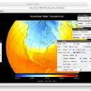
... an utility that enable user to plot raster image. Depending on the data, it can draw global longitude-latitude images or pole-to-pole latitude-vertical images.Panoply is a cross-platform application which plots geo-gridded arrays from netCDF, HDF and GRIB datasets. The utility can also combine two arrays and can project the analysis using more than 100 maps. ...

Author Robert B. Schmunk
Released 2024-03-29
Filesize 36.40 MB
Downloads 501
OS Mac OS X
Installation Instal And Uninstall
Keywords plot raster image, longitude image, pole-to-pole image, raster image, rasterize, raster
Users' rating
(24 rating)
Panoply for MacCADMac OS X
Panoply for Mac - export to image Freeware Download Notice

Panoply for Mac Free Download - we do not host any Panoply for Mac torrent files or links of Panoply for Mac on rapidshare.com, depositfiles.com, megaupload.com etc. All Panoply for Mac download links are direct Panoply for Mac download from publisher site or their selected mirrors.

Panoply for Mac freeware - The Latest User Reviews
Panoply for Mac freeware - The Latest Versions History
5.3.4 Mar 29, 2024 New Release
5.3.3 Mar 1, 2024 New Release
5.3.2 Jan 31, 2024 New Release

Most popular CAD freeware downloads

Panoply for Mac

5.3.4 freeware download

... to disk GIF, JPEG, PNG or TIFF bitmap images or as PDF or PostScript graphics files. Export lon-lat map plots in KMZ format. Export animations as MP4 video or as a collection ...

TNTmips for Mac OS X

20240111 freeware download

... with virtually any type of geospatial data including imagery, terrain surfaces, and map data with associated database ... without importing. Overlay your geodata on Bing Maps imagery and maps or on geodata layers published on ...

TNTmips

20240404 freeware download

... with virtually any type of geospatial data including imagery, terrain surfaces, and map data with associated database ... without importing. Overlay your geodata on Bing Maps imagery and maps or on geodata layers published on ...

Panoply

5.3.4 freeware download

... whose purpose is to help you plot raster images. It lets you view photos created with NetCDF, ... the beginning of the review and print or export plots to KMZ, GIF, PDF, PNG, PS, AVI ...

Sweet Home 3D

7.3 freeware download

... draw the walls of your home upon the image of an existing plan, change the color or ... along with the 3D view, create a photorealistic image of the 3D view, and export the plan ...

Digimizer

6.4.0 freeware download

Digimizer is an easy-to-use and flexible image analysis software package that allows precise manual measurements ... BMP, PNG, WMF, EMF and DICOM files. Images can be rotated, flipped or straightened. Image brightness ...

Gwyddion

2.65 freeware download

... generally used for any other height field and image analysis, for instance for analysis of profilometry data ... profile extraction, measuring distances in profile graph, profile export · filtering: mean, median, conservative denoise, Kuwahara, minimum, ...

Gwyddion for Linux

2.65 freeware download

... generally used for any other height field and image analysis, for instance for analysis of profilometry data ... profile extraction, measuring distances in profile graph, profile export · filtering: mean, median, conservative denoise, Kuwahara, minimum, ...

VEGA ZZ

3.2.3.28 freeware download

... PDBQT multi-model formats. Snapshot, hardware and software image rendering with the capability to create images bigger than the monitor size. The software rendering ... Vector graphic rendering engine. It's possible to export the view in LaTex, PostScript, Encapsulated PostScript, PDF, ...

SeiSee

2.22.6 freeware download

... variable area, variable density, color) - scaling seismic image, gain control, axes labeling setup - plots seismic to printer (plotter) - exports the image in Windows Bitmap (.bmp) and PostScript ...