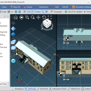
Br3D 1.3 freeware

Supports various 3D file format. Read : DWG, DXF, IFC, IFCZIP, STL, STEP, STP, OBJ, LAS, JT, 3DS, IGES, IGS Write : DWG, HTML, STEP, STP, STL, IGES, IGS, PRC, XML Draw Line, Circle, Arc, Text, Multiline Text, Polyline, Spline, Insert Model, Insert Block, Insert Image Draw 3D Box, Cylinder, Cone, Torus, Sphere Terrain Create terrain(by layer, by entity, by grid), Up/Down terrain, Coloring terrain(gradation), Create contour ...

Author HaNee Soft
Released 2022-11-05
Filesize 0 kB
Downloads 127
OS Win2000, Windows XP, Windows 7 x32, Windows 7 x64, Windows 8, Windows 10, WinServer, WinOther, Windows Vista, Windows Vista x64
Installation Install and Uninstall
Keywords DWG, DXF, IFC, IFCZIP, STL, STEP, STP, OBJ, LAS, 3DS, IGES, IGS
Users' rating
(17 rating)
Br3DCADWin2000, Windows XP, Windows 7 x32, Windows 7 x64, Windows 8, Windows 10, WinServer, WinOther, Windows Vista, Windows Vista x64
Br3D - file viewer Freeware Download Notice

Br3D Free Download - we do not host any Br3D torrent files or links of Br3D on rapidshare.com, depositfiles.com, megaupload.com etc. All Br3D download links are direct Br3D download from publisher site or their selected mirrors.

Br3D freeware - The Latest User Reviews
Br3D freeware - The Latest Versions History
1.3 Nov 5, 2022 Major Update

Most popular CAD freeware downloads

Mini CAD Viewer

3.7.0.0 freeware download

Mini CAD Viewer is a compact free CAD viewer.It is designed to be easy to use, even ... supports DWG, DWF, DXF formats. It allows drawing file to be printed. ...

TNTatlas for Mac OS X

2024 B20240508 freeware download

TNTatlas is a powerful free geodata viewer that lets you publish and distribute your maps and geospatial data — from a single geodata file to complex map layouts prepared using TNTmips. TNTatlas ...

MicroDicom

2024.2 freeware download

... *.bmp, *.gif, etc) Open and save DICOM directory files Display of patient list from DICOMDIR Display images ... images to the most common picture formats, movie file format(.avi) and clipboard Brightness/contrast control Zooming and panning ...

TNTatlas

2024 B20240606 freeware download

TNTatlas is a powerful free geodata viewer that lets you publish and distribute your maps and geospatial data — from a single geodata file to complex map layouts prepared using TNTmips. TNTatlas ...

VariCAD Viewer for Linux

2024 2.01 freeware download

VariCAD Viewer is a free viewer, convertor and printing software working with 2D DWG, DXF, 3D STEP and 2D/3D VariCAD file formats. VariCAD viewer allows you to convert DWG ...

QGIS

3.36.1 freeware download

... initial goal was to provide a GIS data viewer. QGIS has reached that point in its evolution ... formats support by the OGR library · MapInfo files · GRASS integration, including view, edit, and analysis ...

QGIS for Mac

3.36.1 freeware download

... initial goal was to provide a GIS data viewer. QGIS has reached that point in its evolution ... formats support by the OGR library · MapInfo files · GRASS integration, including view, edit, and analysis ...

MicroDicom x64

2024.2 freeware download

... *.bmp, *.gif, etc) Open and save DICOM directory files Display of patient list from DICOMDIR Display images ... images to the most common picture formats, movie file format(.avi) and clipboard Brightness/contrast control Zooming and panning ...

QFitsView

8.6 freeware download

... analyzing astronomical images, supporting a wide array of file formats including FITS, which is the standard in the field. Its intuitive interface allows users to ...

QGIS for Linux

3.36.1 freeware download

... initial goal was to provide a GIS data viewer. QGIS has reached that point in its evolution ... formats support by the OGR library · MapInfo files · GRASS integration, including view, edit, and analysis ...