Marvin Suite 20.20.0 freeware

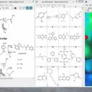
MarvinSpace can be used as an accurate 3D molecular structure visualization program. It can display all types of macromolecules, including proteins and nucleic acids. Users can rotate the camera for a better angle and animations can be run to expose all the bonds. ...

Author ChemAxon Ltd.
Released 2020-11-05
Filesize 129.00 MB
Downloads 362
OS Windows 7, Windows 7 x64, Windows 8, Windows 8 x64, Windows 10, Windows 10 x64
Installation Instal And Uninstall
Keywords Create molecule structure, Molecule structure checker, 3D molecule viewer, Chemistry, Molecule, Structure, Atom
Users' rating
(13 rating)
Marvin SuiteCADWindows 7, Windows 7 x64, Windows 8, Windows 8 x64, Windows 10, Windows 10 x64
Marvin Suite - file viewer Freeware Download Notice

Marvin Suite Free Download - we do not host any Marvin Suite torrent files or links of Marvin Suite on rapidshare.com, depositfiles.com, megaupload.com etc. All Marvin Suite download links are direct Marvin Suite download from publisher site or their selected mirrors.

Marvin Suite freeware - The Latest User Reviews
Marvin Suite freeware - The Latest Versions History
20.20.0 Nov 5, 2020 New Release
20.10.0 Apr 8, 2020 New Release Improvements:
Grid visibility is now kept between sessions.
It is now possible to choose between full structure search and substructure search through a dialog box when initiating a Reaxys search.
20.9.0 Feb 10, 2020 New Release Improvements:
Grid visibility is now kept between sessions.
It is now possible to choose between full structure search and substructure search through a dialog box when initiating a Reaxys search.

Most popular CAD freeware downloads

TNTatlas

2024 B20240606 freeware download

TNTatlas is a powerful free geodata viewer that lets you publish and distribute your maps and geospatial data — from a single geodata file to complex map layouts prepared using TNTmips. TNTatlas ...

QGIS for Mac

3.36.1 freeware download

... initial goal was to provide a GIS data viewer. QGIS has reached that point in its evolution ... formats support by the OGR library · MapInfo files · GRASS integration, including view, edit, and analysis ...

QGIS for Linux

3.36.1 freeware download

... initial goal was to provide a GIS data viewer. QGIS has reached that point in its evolution ... formats support by the OGR library · MapInfo files · GRASS integration, including view, edit, and analysis ...

Mini CAD Viewer

3.7.0.0 freeware download

Mini CAD Viewer is a compact free CAD viewer.It is designed to be easy to use, even ... supports DWG, DWF, DXF formats. It allows drawing file to be printed. ...

Jmol

14.31.53 freeware download

... Jmol's features include reading a variety of file types and output from quantum chemistry programs, and animation of multi-frame files and computed normal modes from quantum programs. ...

Jmol for Linux

14.31.53 freeware download

... Jmol's features include reading a variety of file types and output from quantum chemistry programs, and animation of multi-frame files and computed normal modes from quantum programs. ...

GOM Inspect

7.5 SR1 freeware download

... for dimensional analysis of 3D point clouds and viewer for ATOS and GOM Inspect Professional data sets. ... as STL, ASCII, ... Free result viewer Full-field measuring data allows for an easy ...

SeiSee

2.22.6 freeware download

... analyze the data about earthquakes stored in SEG-Y files. The program can also view the content of CWP, CGG and CST files in order to examine the data.You can use ...

Cytoscape for Linux

3.10.0 freeware download

... network and molecular profiling analyses, new layouts, additional file format support, scripting, and connection with databases. Plugins ... supports a lot of standard network and annotation file formats including: SIF (Simple Interaction Format), GML, XGMML, ...

CARIS Easy View

4.2.13 freeware download

... view spatial data imported from numerous types of files. It allows you to load multiple layers, change ... View your spatial data using the free CARIS viewer. CARIS Easy View allows users to view spatial ...