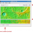
JMARS for Windows 3.1.5 freeware

JMARS is an acronym that stands for Java Mission-planning and Analysis for Remote Sensing. It is a geospatial information system (GIS) developed by ASU's Mars Space Flight Facility to provide mission planning and data-analysis tools to NASA's orbiters, instrument team members, students of all ages, and the general public. ...

Author Arizona State University
Released 2014-08-12
Filesize 50.00 MB
Downloads 587
OS Windows Vista, Windows Vista x64, Windows 7, Windows 7 x64
Installation Instal And Uninstall
Keywords mission analysis, geospatial information, GIS analysis, mission, analysis, GIS
Users' rating
(26 rating)
JMARS for WindowsCADWindows Vista, Windows Vista x64, Windows 7, Windows 7 x64
JMARS for Windows - for c c Freeware Download Notice

JMARS for Windows Free Download - we do not host any JMARS for Windows torrent files or links of JMARS for Windows on rapidshare.com, depositfiles.com, megaupload.com etc. All JMARS for Windows download links are direct JMARS for Windows download from publisher site or their selected mirrors.

JMARS for Windows freeware - The Latest User Reviews
JMARS for Windows freeware - The Latest Versions History
3.1.5 Aug 12, 2014 New Release - In JMARS, locate the "Options" tab at the top of the screen, click it
- Click "Check for Updates"
3.0.4 Jun 7, 2013 New Release - minor change that will allow users to use Body->reset layers to reset layers to JMARS default/startup state
- minor bug fix in the interaction of the Main view and Panner views
- accuracy of crater layer settings improved when saving crater layers as part of a saved session
- more graceful error handling when loading a saved session
- removed the ESRI option from the list for loading/saving in the shape layer. The Geo tools ESRI option is the replacement
- a fix for a drawing issue in the TES layer on Mac OS X running Java 7
- lower right corner coordinates added to the high resolution export tool including new UI functionality for setting export height and width
- update to how image corners (lat/lon) are specified in high resolution export
- added CSV export and look and feel changes to the Investigate tool
- improved communication between the Stamp Layer and backend databases
- Add Layer UI look and feel improvements
- ease of use changes to crater counting layer for small bodies

Most popular CAD freeware downloads

Model Air Design

2.5 freeware download

Model Aircraft Design software for Windows PC. Model Air Design is the new, ... create airplane models. It's a modern software tool for model aircraft design. Model Air Design is for ...

Kst for Linux

2.0.7 freeware download

... spectra. · Color mapping and contour mapping capabilities for three-dimensional data, as well as matrix and image ... interface. · Powerful graphical user interface. · Support for several popular data formats. · Multiple tabs. · ...

PolyRootsRB for Linux

1.3 freeware download

PolyRootsRB finds the roots of a polynomial to any chosen accuracy using Laguerre's Method. The coefficients of the polynomial can be real or complex. PolyRootsRB uses ...

miRPI

1.0 freeware download

MicroRNAs (miRNAs) are newly discovered class of non-coding small RNAs of 20-24 nucleotide length that regulate gene and protein expression in plants and animals. MiRNAs have ...

FilterPro Desktop

3.1.0.23446 freeware download

... active filter design software is free and available for download now. FilterPro v3.1 Active Filter Design ... the following features: NEW Differential Multiple-Feedback topology for Low-pass, High-pass, and Band-pass filters NEW Support for ...

Portable MicroDicom

2024.2 freeware download

MicroDicom is application for primary processing and preservation of medical images in ... format. It is equipped with most common tools for manipulation of DICOM images and it has an ...

Panoply for Mac

5.4.3 freeware download

Panoply for Mac is a cross-platform application which plots geo-gridded ... map plots. Use any of numerous color tables for the scale colorbar, or apply your own custom ...

3D Home Design by Livecad

3.1 freeware download

3D Home Design by LiveCAD® : the solution for easily designing plans in line with regulatory standards, ... Design by LiveCAD® : a true professional solution for all types of buildings! - 2D plans with ...

Mobile Atlas Creator for Mac OS X

2.2.1 freeware download

... open source (GPL) program which creates offline atlases for GPS handhelds and cell phone applications like TrekBuddy, ... other Android and WindowsCE based applications. For the full list of supported applications please see ...

OpenDCL Studio

9.1.5.2 freeware download

... easy-to-use and accessible insturment that is specially designed for AutoLISP programmers that want to replace AutoCAD's limited DCL. They can replace the Dialog Control ...