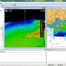
CARIS Easy View 4.2.13 freeware

... three-dimensional mode, allowing you to view your project from any angle. It is even possible to record videos of your fly-throughs and save them to AVI files. ...

Author CARIS
Released 2015-08-27
Filesize 106.00 MB
Downloads 498
OS Windows XP, Windows Vista, Windows Vista x64, Windows 7, Windows 7 x64, Windows 8, Windows 8 x64, Windows 10, Windows 10 x64
Installation Instal And Uninstall
Keywords View Spatial Data, View Map, Analyze Map, Map, Model, Surface, Geography
Users' rating
(17 rating)
CARIS Easy ViewCADWindows XP, Windows Vista, Windows Vista x64, Windows 7, Windows 7 x64, Windows 8, Windows 8 x64, Windows 10, Windows 10 x64
CARIS Easy View - from Freeware Download Notice

CARIS Easy View Free Download - we do not host any CARIS Easy View torrent files or links of CARIS Easy View on rapidshare.com, depositfiles.com, megaupload.com etc. All CARIS Easy View download links are direct CARIS Easy View download from publisher site or their selected mirrors.

CARIS Easy View freeware - The Latest User Reviews
CARIS Easy View freeware - The Latest Versions History
4.2.13 Aug 27, 2015 New Release Consistent user experience in 2D and 3D
The properties for coverages have been redesigned and apply both in 2D and 3D. A number of new options are presented including the ability to drape high resolution imagery (e.g. backscatter) over elevations in both 2D and 3D views.
Also, a new user interface is provided to investigate the processing lineage of a dataset recorded in the metadata.
Click to return to top of page
Coordinate reference system enhancements
The coordinate reference system (CRS) functionality has been augmented with EPSG CRS and transformations, such as NTv2. The user interface was upgraded with a new look and with additional capabilities. Users can now build a favourites list, see a list of recently used CRS entries, search for new entries and investigate all aspects of the selected reference system or transformation.
Note that if an incorrect CRS has been selected when opening a dataset in the application, it is now possible to change the CRS in the Properties window wh
4.1.11 Aug 27, 2015 New Release Expanded support for commonly used geospatial data formats (e.g. BAG, GeoTIFF, S-57) and web services (WMS, WCS, WMTS, WTMS).
Upgraded support for non-proprietary BAG format to version 1.5.2, which is the latest
version provided by the Open Navigation Surface Working Group.

Most popular CAD freeware downloads

Panoply for Mac

5.4.3 freeware download

... is a cross-platform application which plots geo-gridded arrays from netCDF, HDF and GRIB datasets. Panoply is designed ... latitude-longitude, latitude-vertical, longitude-vertical, time-latitude or time-vertical arrays sliced from 2D or larger multidimensional variables. Create color contour ...

FilterPro Desktop

3.1.0.23446 freeware download

... accounts for passband ripple Supports design file migration from FilterPro v2 so that designs created in the prior version can benefit from the functionality of v3.1. Easily generate schematics, view ...

GelAnalyzer

23.1.1 freeware download

... and covers all the main aspects of evaluation from automatic lane detection to precise molecular weight calculations. Many tools help you to improve the accuracy ...

miRPI

1.0 freeware download

... a new software that finds highly conserved miRNAs from the given gene sequences by using non-repeated miRNAs of the users interest. The software ...

CyFluxViz

0.92 freeware download

... EPS, PDF, BMP, PNG) Batch capabilities Publications originating from the use of CyFluxViz should cite the the following publication ...

FieldVIZ

r165 freeware download

FieldVIZ is meant to allow easy visual inspection of electro- and magnetostatic fields in 2D and 3D. ...

Aqsis Renderer for Mac OS X

1.8.2 freeware download

... needs the high level surface descriptions to render from, reducing the data passed to the renderer, while ensuring a perfectly smooth silhouette edge. Some other ...

HeeksCAD

0.20.0 freeware download

... free, open source, CAD application. Import solid models from STEP and IGES files. Draw construction geometry and ... the geometric constraints solver to create accurate drawings from rough sketches. HeeksCAD can be translated ...

SoundStepper

5.4.1.304 freeware download

... example a sky map, autoguiding, or capture images from a webcam or CCD. In this system, ... mounts (ex: Fork, yoke, horseshoe, split-ring), and beginning from 5.0 beta version, altazimuthal mounts too. SoundStepper ...

MuniWin for Linux

2.0.21 freeware download

... Each step of reduction process can be run from the command line or via simple and intuitive graphical user interface. The project follows up ...