BimRoad Plus freeware

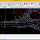
Parametric road design. The world's first software for automatic interchange design. Three-dimensional alignment design. Real-time interchange redesign considering design standards by changing the main alignment. All type of interchange design using user defined connection road. Automatic connection road plan by editing nose point. Automatic correction of road plan design element using parametric method. ...

Author HaneeSoft
Released 2015-01-01
Filesize 232.65 MB
Downloads 245
OS Win2000, Windows XP, Windows 7 x32, Windows 7 x64, Windows 8, Windows 10, WinServer, WinOther, Windows Vista, Windows Vista x64
Installation Install and Uninstall
Keywords Road design, Interchange design, Alignment, Earthwork
Users' rating
(10 rating)
BimRoadCADWin2000, Windows XP, Windows 7 x32, Windows 7 x64, Windows 8, Windows 10, WinServer, WinOther, Windows Vista, Windows Vista x64
BimRoad - gis map Freeware Download Notice

BimRoad Free Download - we do not host any BimRoad torrent files or links of BimRoad on rapidshare.com, depositfiles.com, megaupload.com etc. All BimRoad download links are direct BimRoad download from publisher site or their selected mirrors.

BimRoad freeware - The Latest User Reviews
BimRoad freeware - The Latest Versions History
Plus Jan 1, 2015 New Release Road design.
Topography creation.
Plane design.
Profile Design.
Interchange automatic design.
Cross section design.
Earthwork.
Hydraulics.
Report / Drawing.

Most popular CAD freeware downloads

TNTmips for Mac OS X

20240111 freeware download

... of geospatial data including imagery, terrain surfaces, and map data with associated database attributes. It provides all ... published on the Internet as web tilesets, Web Map Service (WMS), and ArcIMS. Automatically generate hundreds ...

QGIS for Mac

3.36.1 freeware download

QGIS is a professional GIS application that is built on top of and ... database formats and lets you browse and create map data on your computer. QGIS supports many ...

QGIS for Linux

3.36.1 freeware download

QGIS is a professional GIS application that is built on top of and ... database formats and lets you browse and create map data on your computer. QGIS supports many ...

TNTmips

20240404 freeware download

... of geospatial data including imagery, terrain surfaces, and map data with associated database attributes. It provides all ... published on the Internet as web tilesets, Web Map Service (WMS), and ArcIMS ... Automatically generate ...

QGIS

3.36.1 freeware download

QGIS is a professional GIS application that is built on top of and ... database formats and lets you browse and create map data on your computer. QGIS supports many ...

Elshayal Smart

23.02 freeware download

Elshayal Smart is the first Arabian GIS software that is completely developed by Arabian developers ... query builder, build network, find shortest path, print map, save map image, copy map image to clipboard, ...

Thuban for Windows

1.2.2 freeware download

... Data Support: GeoTIFF Layer and GDAL # Comfortable Map Navigation # Object Identification and Annotation # Legend ... FreeGIS Project provides an overview of Free Software GIS projects. Many valuable and highly sophisticated tools exist, ...

Thuban for Mac OS X

1.0.1-3 freeware download

... Data Support: GeoTIFF Layer and GDAL # Comfortable Map Navigation # Object Identification and Annotation # Legend ... FreeGIS Project provides an overview of Free Software GIS projects. Many valuable and highly sophisticated tools exist, ...

Thuban for Linux

1.2.2 freeware download

... Data Support: GeoTIFF Layer and GDAL # Comfortable Map Navigation # Object Identification and Annotation # Legend ... FreeGIS Project provides an overview of Free Software GIS projects. Many valuable and highly sophisticated tools exist, ...

JMARS

3.1.5 freeware download

... be created by drawing multi-segment lines on the map, making it easy to sample elevation, thermal inertia, ... common formats. * Edit vector data on the map or in a table. * Use vector processing ...

5 freeware award