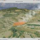
Virtual Terrain Project for Windows 1.1 110804 freeware

The goal of VTP is to foster the creation of tools for easily constructing any part of the real world in interactive, 3D digital form.

This goal will require a synergetic convergence of the fields of CAD, GIS, visual simulation, surveying and remote sensing. VTP gathers information and tracks progress in areas such as procedural scene construction, feature extraction, and rendering algorithms. ...

Author Ben Discoe
Released 2011-09-08
Filesize 1.00 MB
Downloads 474
OS Windows 2000, Windows 2003, Windows XP, Windows Vista
Installation Instal And Uninstall
Keywords libraries, demos, data, open source, VirtualTerrain Project, CAD, GIS, VTP
Users' rating
(19 rating)
Virtual Terrain Project for WindowsCADWindows 2000, Windows 2003, Windows XP, Windows Vista
Virtual Terrain Project for Windows - help Freeware Download Notice

Virtual Terrain Project for Windows Free Download - we do not host any Virtual Terrain Project for Windows torrent files or links of Virtual Terrain Project for Windows on rapidshare.com, depositfiles.com, megaupload.com etc. All Virtual Terrain Project for Windows download links are direct Virtual Terrain Project for Windows download from publisher site or their selected mirrors.

Virtual Terrain Project for Windows freeware - The Latest User Reviews
Virtual Terrain Project for Windows freeware - The Latest Versions History
1.1 110804 Sep 8, 2011 New Release Enviro:
Exposed support for more stereo modes: Horizontal and Vertical split.
Options to enable joystick and spacenavigator, rather than just always using them if present.
Smooth continuous update when making buildings.
Option to constrain building point to right angles. Deter user from making bad points.
Made support for Collada (.dae) more explicit in the UI.
Display the version number in the startup dialog.
Added 'every N meters' option to Contour dialog, making it significantly more useful.
Changed 'Move' mode to use Alt modifier key for up/down, to be consistent.
Fixed issues with: support for elevation grids with non-unit vertical scale; removing layers from a terrain; saving snapshot and high-resolution snapshot; buildings with a Geographic CRS; draping of 2D polylines on terrain with vertical exaggeration.

VTBuilder:
Raw layers: Draw polygon holes as dotted lines to tell them from outer edges.

Most popular CAD freeware downloads

GelAnalyzer

23.1.1 freeware download

GelAnalyzer is a small application specially designed to help you with the 1D gel electrophoresis image analysis. ... detection to precise molecular weight calculations. Many tools help you to improve the accuracy of gel evaluation, ...

Panoply for Mac

5.4.3 freeware download

... HDF and GRIB datasets. Panoply is designed to help you view and process the data included in ... user interface is organized into multiple tabs that help you browse between datasets and catalogues, to adjust ...

FilterPro Desktop

3.1.0.23446 freeware download

... reports containing all design data and schematics to help speed time to market. Supports Bessell, Butterworth, Chebychev, ... band-pass, and all-pass phase shift/time delay filters to help ease system design. ...

Gephi

0.10.1 freeware download

... to reveal hidden properties. The goal is to help data analysts to make hypothesis, intuitively discover patterns, isolate structure singularities or faults during data sourcing. ...

EQAlign

2.3.7 freeware download

... repository. We will be happy to receive your help, of course, you can join to developing group. ...

enCIFer for Mac OS X

1.4 freeware download

The Crystallographic Information File (CIF) is the internationally agreed standard file format for information exchange in crystallography. The CIF standard is supported, maintained and developed by ...

TinyCAD

3.00.04 freeware download

TinyCAD is a program to help you draw circuit diagrams. It comes complete with symbol libraries to get you started straight away. As well as ...

Wing Geometry

1.6.1 freeware download

... the time, so I wrote this program to help me out. To use this program, simply enter any parameters that you know, and the others ...

TNTatlas

2024 B20240606 freeware download

TNTatlas is a powerful free geodata viewer that lets you publish and distribute your maps and geospatial data — from a single geodata file to complex ...

Apriori x64

5.73 freeware download

A program to find association rules and frequent item sets (also closed and maximal as well as generators) with the Apriori x64 algorithm (Agrawal et al. ...