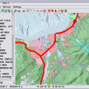
TNTmips 20240404 freeware

TNTmips is a geospatial image processing tool that allows you to analyze and modify GIS images. It is a professional application that can handle desktop cartography, electronic atlas preparation and spatial database management. ...

Author MicroImages, Inc.
Released 2024-04-04
Filesize 121.00 MB
Downloads 1645
OS Windows XP, Windows Vista, Windows Vista x64, Windows 7, Windows 7 x64, Windows 8, Windows 8 x64, Windows 10, Windows 10 x64, Windows 11
Installation Instal And Uninstall
Keywords GIS data analysis, analyze geodetic data, edit GIS dataset, GIS, dataset, editor, analysis
Users' rating
(116 rating)
TNTmipsCADWindows XP, Windows Vista, Windows Vista x64, Windows 7, Windows 7 x64, Windows 8, Windows 8 x64, Windows 10, Windows 10 x64, Windows 11
TNTmips - image software Freeware Download Notice

TNTmips Free Download - we do not host any TNTmips torrent files or links of TNTmips on rapidshare.com, depositfiles.com, megaupload.com etc. All TNTmips download links are direct TNTmips download from publisher site or their selected mirrors.

TNTmips freeware - The Latest User Reviews
TNTmips freeware - The Latest Versions History
20240404 Apr 4, 2024 New Release
20240131 Jan 31, 2024 New Release
20240108 Jan 8, 2024 New Release

Most popular CAD freeware downloads

MarvinSketch

23.16.0 freeware download

... and user-defined templates and context-sensitive popup menus. The software contains a rich feature set that includes many ... Structure and valence checker Working with abbreviated groups Image generation, display and formatting ...

Digimizer

6.4.0 freeware download

Digimizer is an easy-to-use and flexible image analysis software package that allows precise manual measurements as well ... BMP, PNG, WMF, EMF and DICOM files. Images can be rotated, flipped or straightened. Image brightness ...

Gwyddion

2.66 freeware download

... generally used for any other height field and image analysis, for instance for analysis of profilometry data ... features). Gwyddion is Free and Open Source software, covered by GNU General Public License. It aims ...

DSI Studio

.59 freeware download

DSI Studio is a software for diffusion MRI processing, including DTI, DSI, and ... (DSI) · Generalized Q-sampling Imaging (GQI) Supported image format: · DICOM (multi-slices/mosaic) · Analyze/NIFTI · bruker ...

Kst

2.0.8 freeware download

... for three-dimensional data, as well as matrix and image support. · Monitoring of events and notifications support. · Built-in filtering and curve fitting capabilities. · ...

Kst for Linux

2.0.7 freeware download

... for three-dimensional data, as well as matrix and image support. · Monitoring of events and notifications support. · Built-in filtering and curve fitting capabilities. · ...

ZeGrapher

2.0.0 freeware download

... choose scale, graph size, ..., in centimeters Export: image or PDF Draw derivatives and anti-derivatives. ...

Engauge Digitizer for Mac OS X

12.0 freeware download

Engauge Digitizer - Digitizing software This open source, digitizing software converts an image file showing a graph or map, into numbers. The image file can come from a scanner, digital camera ...

5 freeware award

Engauge Digitizer for Linux

12.0 freeware download

Engauge Digitizer - Digitizing software This open source, digitizing software converts an image file showing a graph or map, into numbers. The image file can come from a scanner, digital camera ...

Elshayal Smart

23.02 freeware download

Elshayal Smart is the first Arabian GIS software that is completely developed by Arabian developers team and independent of any commercial software package. Download Maps from Google Earth, and ...