Energy2D for Mac OS X 2.6 freeware

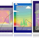
Energy2D is a small, simple, Java based application specially designed to offer you an interactive simulation of heat and mass flow. All that you have to do is select the model which interests you and you can start your analysis. ...

Author Concord Consortium
Released 2017-09-01
Filesize 67.50 MB
Downloads 626
OS Mac OS X
Installation Instal And Uninstall
Keywords heat flow simulation, simulate mass flow, analyze heat flow, simulate, simulator, simulation
Users' rating
(13 rating)
Energy2D for Mac OS XCADMac OS X
Energy2D for Mac OS X - image Freeware Download Notice

Energy2D for Mac OS X Free Download - we do not host any Energy2D for Mac OS X torrent files or links of Energy2D for Mac OS X on rapidshare.com, depositfiles.com, megaupload.com etc. All Energy2D for Mac OS X download links are direct Energy2D for Mac OS X download from publisher site or their selected mirrors.

Energy2D for Mac OS X freeware - The Latest User Reviews
Energy2D for Mac OS X freeware - The Latest Versions History
2.6 Sep 1, 2017 New Release
2.0 Sep 16, 2014 New Release Multiphysics
Radiation modeling
Particle-fluid coupling
Lots of updates
1.3 Jul 2, 2014 New Release New:
Radiation to a Concave Shape
Radiation in a Box
PTC/NTC Heaters
Thermophoresis
Multiple Phases
Multiphysics features:
radiation and particle simulations.

Most popular CAD freeware downloads

Panoply for Mac

5.3.4 freeware download

... to disk GIF, JPEG, PNG or TIFF bitmap images or as PDF or PostScript graphics files. Export ... video or as a collection of invididual frame images. Explore remote THREDDS and OpenDAP catalogs and open ...

TNTmips for Mac OS X

20240111 freeware download

... with virtually any type of geospatial data including imagery, terrain surfaces, and map data with associated database ... without importing. Overlay your geodata on Bing Maps imagery and maps or on geodata layers published on ...

TNTmips

20240404 freeware download

... with virtually any type of geospatial data including imagery, terrain surfaces, and map data with associated database ... without importing. Overlay your geodata on Bing Maps imagery and maps or on geodata layers published on ...

Panoply

5.3.4 freeware download

... whose purpose is to help you plot raster images. It lets you view photos created with NetCDF, ... application that helps you plot and analyze raster images of geo-gridded data from NetCDF and other datasets. ...

Sweet Home 3D

7.3 freeware download

... draw the walls of your home upon the image of an existing plan, change the color or ... along with the 3D view, create a photorealistic image of the 3D view, and export the plan ...

MarvinSketch

23.16.0 freeware download

... Structure and valence checker Working with abbreviated groups Image generation, display and formatting ...

GelAnalyzer

23.1.1 freeware download

... to help you with the 1D gel electrophoresis image analysis. The process of gel image analysis is straightforward and covers all the main ...

Digimizer

6.4.0 freeware download

Digimizer is an easy-to-use and flexible image analysis software package that allows precise manual measurements ... BMP, PNG, WMF, EMF and DICOM files. Images can be rotated, flipped or straightened. Image brightness ...

pCon.planner

8.9.0.100 freeware download

... Optimal handling of data - Realistic, on-demand product images with OSPRay - Sharing of pCon.planner panoramas directly ... Setting back-up folder for plans - OSPRay: Improved Image Quality - Rendering Animations with OSPRay - Exporting ...

Gwyddion

2.65 freeware download

... generally used for any other height field and image analysis, for instance for analysis of profilometry data ... axes scale callibration · merging and immersion of images · tip modelling, blind estimation, dilation and erosion ...