pCon.planner 8.9.0.100 freeware

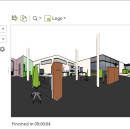
The pCon.planner is a cost-free application allowing you to comfortably and professionally create complex furnishing concepts and to visualize them in a photo-realistic quality. The pCon.planner allows you to access the web catalogs of numerous manufacturers and dealers in the furnishing industry. You load the objects directly into your planning and thus equip the rooms with real high-quality 3D models. ...

Author EasternGraphics
Released 2023-11-01
Filesize 297.00 MB
Downloads 1657
OS Windows 7 x64, Windows 8 x64, Windows 10 x64, Windows 11
Installation Instal And Uninstall
Keywords 3D design tool, furnishing design, interior designer, 3D design, designer, furnishing
Users' rating
(24 rating)
pCon.plannerCADWindows 7 x64, Windows 8 x64, Windows 10 x64, Windows 11
pCon.planner - image Freeware Download Notice

pCon.planner Free Download - we do not host any pCon.planner torrent files or links of pCon.planner on rapidshare.com, depositfiles.com, megaupload.com etc. All pCon.planner download links are direct pCon.planner download from publisher site or their selected mirrors.

pCon.planner freeware - The Latest User Reviews
pCon.planner freeware - The Latest Versions History
8.9.0.100 Nov 1, 2023 New Release
8.8.1.100 Jul 5, 2023 New Release
8.8.0.101 Jan 19, 2023 New Release

Most popular CAD freeware downloads

Panoply for Mac

5.3.4 freeware download

... to disk GIF, JPEG, PNG or TIFF bitmap images or as PDF or PostScript graphics files. Export ... video or as a collection of invididual frame images. Explore remote THREDDS and OpenDAP catalogs and open ...

TNTmips for Mac OS X

20240111 freeware download

... with virtually any type of geospatial data including imagery, terrain surfaces, and map data with associated database ... without importing. Overlay your geodata on Bing Maps imagery and maps or on geodata layers published on ...

TNTmips

20240404 freeware download

... with virtually any type of geospatial data including imagery, terrain surfaces, and map data with associated database ... without importing. Overlay your geodata on Bing Maps imagery and maps or on geodata layers published on ...

Panoply

5.3.4 freeware download

... whose purpose is to help you plot raster images. It lets you view photos created with NetCDF, ... application that helps you plot and analyze raster images of geo-gridded data from NetCDF and other datasets. ...

Sweet Home 3D

7.3 freeware download

... draw the walls of your home upon the image of an existing plan, change the color or ... along with the 3D view, create a photorealistic image of the 3D view, and export the plan ...

MarvinSketch

23.16.0 freeware download

... Structure and valence checker Working with abbreviated groups Image generation, display and formatting ...

GelAnalyzer

23.1.1 freeware download

... to help you with the 1D gel electrophoresis image analysis. The process of gel image analysis is straightforward and covers all the main ...

Digimizer

6.4.0 freeware download

Digimizer is an easy-to-use and flexible image analysis software package that allows precise manual measurements ... BMP, PNG, WMF, EMF and DICOM files. Images can be rotated, flipped or straightened. Image brightness ...

pCon.planner

8.9.0.100 freeware download

... Optimal handling of data - Realistic, on-demand product images with OSPRay - Sharing of pCon.planner panoramas directly ... Setting back-up folder for plans - OSPRay: Improved Image Quality - Rendering Animations with OSPRay - Exporting ...

Gwyddion

2.65 freeware download

... generally used for any other height field and image analysis, for instance for analysis of profilometry data ... axes scale callibration · merging and immersion of images · tip modelling, blind estimation, dilation and erosion ...