JMARS 3.1.5 freeware

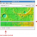
JMARS is an acronym that stands for Java Mission-planning and Analysis for Remote Sensing. It is a geospatial information system (GIS) developed by ASU's Mars Space Flight Facility to provide mission planning and data-analysis tools to NASA's orbiters, instrument team members, students of all ages, and the general public. ...

Author Arizona State University
Released 2014-08-12
Filesize 50.00 MB
Downloads 738
OS Linux, Mac OS X
Installation Instal And Uninstall
Keywords mission analysis, geospatial information, GIS analysis, mission, analysis, GIS
Users' rating
(22 rating)
JMARSCADLinux, Mac OS X
Our rating 5 freeware award
JMARS - images features Freeware Download Notice

JMARS Free Download - we do not host any JMARS torrent files or links of JMARS on rapidshare.com, depositfiles.com, megaupload.com etc. All JMARS download links are direct JMARS download from publisher site or their selected mirrors.

JMARS freeware - The Latest User Reviews
JMARS freeware - The Latest Versions History
3.1.5 Aug 12, 2014 New Release - In JMARS, locate the "Options" tab at the top of the screen, click it
- Click "Check for Updates"
3.0.4 Jun 7, 2013 New Release - minor change that will allow users to use Body->reset layers to reset layers to JMARS default/startup state
- minor bug fix in the interaction of the Main view and Panner views
- accuracy of crater layer settings improved when saving crater layers as part of a saved session
- more graceful error handling when loading a saved session
- removed the ESRI option from the list for loading/saving in the shape layer. The Geo tools ESRI option is the replacement
- a fix for a drawing issue in the TES layer on Mac OS X running Java 7
- lower right corner coordinates added to the high resolution export tool including new UI functionality for setting export height and width
- update to how image corners (lat/lon) are specified in high resolution export
- added CSV export and look and feel changes to the Investigate tool
- improved communication between the Stamp Layer and backend databases
- Add Layer UI look and feel improvements
- ease of use changes to crater counting layer for small bodies
1.25 Aug 22, 2011 New Release General:
· The Look and Feel of JMARS should now be more consistent with the platform it is on.

Map Layer:
· Added a "View Citations" button to the source section of the Map Layer focus panel.
· Custom Map Upload fix to prevent

Most popular CAD freeware downloads

GGCad Free Edition

2.1.0.5 freeware download

... set of tools. It does support quoting, hatches, images, texts. Printing is fully configurable. It contains drawing ... API for script integration with GGCad. This script features allow you to imagine and bring your own ...

Digimizer

6.4.0 freeware download

... BMP, PNG, WMF, EMF and DICOM files. Images can be rotated, flipped or straightened. Image brightness ... be adjusted. Several filters can be applied. FEATURES: Image file operations Open, save and ...

TinyCAD

3.00.04 freeware download

... for use in your own projects. The features of TinyCAD: * Drawing Overview * Web ... Create PCBs * Simulate with Spice * TinyCAD Features Web & Word Creating Circuit Diagrams ...

Gwyddion

2.66 freeware download

... analysis of profilometry data (learn more about Gwyddion features). Gwyddion is Free and Open Source software, ... systems supported by Gtk+ should be possible. FEATURES: · visualization: false color representation with different ...

DSI Studio

.59 freeware download

... reconstruction as well as fiber tracking. Among the features of DSI Studio are distributed computing and multithread ... a try to fully assess its capabilities! FEATURES: Reconstruction: · Diffusion tensor imaging (DTI), · ...

JMARS

3.1.5 freeware download

... data, and has basic image and vector processing features to conveniently compare, plot, and blend data. ... or night), plot footprints and render remote sensing images from orbiters. * Correlate mineral compositions with topographic ...

5 freeware award

JMARS for Windows

3.1.5 freeware download

... data, and has basic image and vector processing features to conveniently compare, plot, and blend data. ... or night), plot footprints and render remote sensing images from orbiters. * Correlate mineral compositions with topographic ...

NetLogo

6.0.4 freeware download

... amount or the albedo (reflection coefficient). FEATURES: Programming: Fully programmable Approachable syntax Language is ... for annotating your model with formatted text and images HubNet: participatory simulations using networked devices Agent monitors ...

Elshayal Smart

23.02 freeware download

... save GPS route and View and Rectify Raster Images gif, jpg, bmp and Edit shape files, build ... zoom in & zoom out, pan, identify, selecting features, invert selection, show data table, data query builder, ...

3D Architecture by LiveCAD

2.1 freeware download

... straight and corner bathtubs, accessories etc. - Calculate images using ray tracing - Global Illumination for a hyper-realistic photo quality rendering - Control the type ...