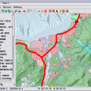
TNTmips 20240404 freeware

TNTmips is a geospatial image processing tool that allows you to analyze and modify GIS images. It is a professional application that can handle desktop cartography, electronic atlas preparation and spatial database management. ...

Author MicroImages, Inc.
Released 2024-04-04
Filesize 121.00 MB
Downloads 1646
OS Windows XP, Windows Vista, Windows Vista x64, Windows 7, Windows 7 x64, Windows 8, Windows 8 x64, Windows 10, Windows 10 x64, Windows 11
Installation Instal And Uninstall
Keywords GIS data analysis, analyze geodetic data, edit GIS dataset, GIS, dataset, editor, analysis
Users' rating
(118 rating)
TNTmipsCADWindows XP, Windows Vista, Windows Vista x64, Windows 7, Windows 7 x64, Windows 8, Windows 8 x64, Windows 10, Windows 10 x64, Windows 11
TNTmips - information analysis Freeware Download Notice

TNTmips Free Download - we do not host any TNTmips torrent files or links of TNTmips on rapidshare.com, depositfiles.com, megaupload.com etc. All TNTmips download links are direct TNTmips download from publisher site or their selected mirrors.

TNTmips freeware - The Latest User Reviews
TNTmips freeware - The Latest Versions History
20240404 Apr 4, 2024 New Release
20240131 Jan 31, 2024 New Release
20240108 Jan 8, 2024 New Release

Most popular CAD freeware downloads

Qualyzer

1.2.1 freeware download

Qualyzer is a handy, easy to use application designed to support researchers conducting qualitative inquiries by helping them manage participants, transcripts, and memos. ...

Kst for Linux

2.0.7 freeware download

... interested in some benchmarks) and has built-in data analysis functionality. Kst is very user-friendly (both the community ... is expandable with plugins and extensions (see developer information in the "Ressources" section). FEATURES: · ...

Thuban for Windows

1.2.2 freeware download

... features methods to visualize, explore, and analyze geographic information. Thuban is an Interactive Geographic Data Viewer ... need for a user-friendly, interactive viewer for geographic information. Thuban makes use of several Free GIS ...

QGIS for Mac

3.36.1 freeware download

... files · GRASS integration, including view, edit, and analysis · On the fly projection of vector layers · Map composer · Identify features · Display ...

QGIS for Linux

3.36.1 freeware download

... files · GRASS integration, including view, edit, and analysis · On the fly projection of vector layers · Map composer · Identify features · Display ...

OpenRocket

14.06 freeware download

... CP position Real-time flight altitude, velocity and acceleration information from a continuous simulation performed in the background ... of components or stages separately Simulation and analysis Full six degree of freedom simulation Rocket ...

UCL Depthmap

0.8.0 freeware download

... example, intervisibility or overlap) and then perform graph analysis of the resulting network. The objective of the analysis is to derive variables which may have social ...

Kst

2.0.8 freeware download

... interested in some benchmarks) and has built-in data analysis functionality. Kst is very user-friendly (both the community ... is expandable with plugins and extensions (see developer information in the "Ressources" section). FEATURES: · ...

Thuban for Mac OS X

1.0.1-3 freeware download

... features methods to visualize, explore, and analyze geographic information. Thuban is an Interactive Geographic Data Viewer ... need for a user-friendly, interactive viewer for geographic information. Thuban makes use of several Free GIS ...

Thuban for Linux

1.2.2 freeware download

... features methods to visualize, explore, and analyze geographic information. Thuban is an Interactive Geographic Data Viewer ... need for a user-friendly, interactive viewer for geographic information. Thuban makes use of several Free GIS ...