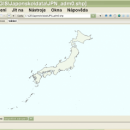
wxGIS Portable 0.4.1 freeware

... is a useful application that allows you to manage and to organize multiple types of geographic information. ... systems in folders. It also includes a vector file export utility and a tool for correcting the orthographic data from raster TIFF files. ...

Author Dmitry Barishnikov
Released 2012-11-15
Filesize 9.70 MB
Downloads 327
OS Windows XP, Windows Vista, Windows Vista x64, Windows 7, Windows 7 x64
Installation Instal And Uninstall
Keywords GIS catalog, manage geography data, geographic coordinate system, manage, catalog, geography
Users' rating
(4 rating)
wxGIS PortableCADWindows XP, Windows Vista, Windows Vista x64, Windows 7, Windows 7 x64
wxGIS Portable - manage file Freeware Download Notice

wxGIS Portable Free Download - we do not host any wxGIS Portable torrent files or links of wxGIS Portable on rapidshare.com, depositfiles.com, megaupload.com etc. All wxGIS Portable download links are direct wxGIS Portable download from publisher site or their selected mirrors.

wxGIS Portable freeware - The Latest User Reviews
wxGIS Portable freeware - The Latest Versions History
0.4.1 Nov 15, 2012 New Release · The DEM interpolation switch (bilinear or cubic) in orthocorrect tool
· Russian interface translation
· Rename item support
· Automatic rename output files in batch export
· The ortho-correction tool become more accurate and speedy

Most popular CAD freeware downloads

Pro Yacht

1.0.0.1 freeware download

... analysis. For the expert designer, the native text file format can be used to overlay flow lines ... and the introduction of new realisation code to manage all information extracted from surfaces. While the hull ...

wxGIS Portable

0.4.1 freeware download

... is a useful application that allows you to manage and to organize multiple types of geographic information. ... systems in folders. It also includes a vector file export utility and a tool for correcting the ...

GstarCAD MC

3.3.1 freeware download

... edit CAD drawings ( DWG, OCF and DXF files) directly on your mobile device after transferring them. ... There is no limit to how large the file is. • Fully compatibility with AutoCAD. (2) No ...

PreviSat

6.1.0.3 freeware download

... details. The results can be exported to TXT file format. PreviSat enables you to manage TLE orbital elements by updating the categories of ... and uploading data from TXT, TLE, or GZ file format. ...

FreeMedForms

1.0.0 freeware download

... specialties and even veterinary profession. The patient file is fully editable. It is built with an XML file that you can modify to suit best for ...

FreeMedForms for Mac OS X

1.0.0 freeware download

... specialties and even veterinary profession. The patient file is fully editable. It is built with an XML file that you can modify to suit best for ...

FreeMedForms Portable

1.0.0 freeware download

... specialties and even veterinary profession. The patient file is fully editable. It is built with an XML file that you can modify to suit best for ...

wxGIS

0.2.0 freeware download

... is a useful application that allows you to manage and to organize multiple types of geographic information. ... systems in folders. It also includes a vector file export utility and a tool for correcting the ...