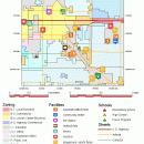
TNTatlas 2022 B20221207 freeware

TNTatlas is a powerful free geodata viewer that lets you publish and distribute your maps ... — from a single geodata file to complex map layouts prepared using TNTmips. TNTatlas lets you display massive sized geodata and will directly display numerous file formats including shapefiles, GeoTIFF, JP2, PNG, MrSID, DXF, and DWG. ...

Author MicroImages, Inc.
Released 2022-12-07
Filesize 59.00 MB
Downloads 2380
OS Windows XP, Windows Vista, Windows Vista x64, Windows 7, Windows 7 x64, Windows 8, Windows 8 x64, Windows 10, Windows 10 x64, Windows 11
Installation Instal And Uninstall
Keywords geospatial viewer, view atlas, visualize geospatial data, atlas, map, viewer
Users' rating
(58 rating)
TNTatlasCADWindows XP, Windows Vista, Windows Vista x64, Windows 7, Windows 7 x64, Windows 8, Windows 8 x64, Windows 10, Windows 10 x64, Windows 11
TNTatlas - map viewer Freeware Download Notice

TNTatlas Free Download - we do not host any TNTatlas torrent files or links of TNTatlas on rapidshare.com, depositfiles.com, megaupload.com etc. All TNTatlas download links are direct TNTatlas download from publisher site or their selected mirrors.

TNTatlas freeware - The Latest User Reviews
TNTatlas freeware - The Latest Versions History
2022 B202212 Dec 7, 2022 New Release
2022 B202211 Nov 30, 2022 New Release
2022 B202211 Nov 23, 2022 New Release

Most popular CAD freeware downloads

Panoply for Mac

5.3.4 freeware download

... one plot by differencing, summing or averaging. Create map plots of trajectory data based on the CF ... Plot lon-lat data on a global or regional map using any of over 200 map projections or ...

QGIS for Mac

3.36.2 freeware download

... database formats and lets you browse and create map data on your computer. QGIS supports many ... initial goal was to provide a GIS data viewer. QGIS has reached that point in its evolution ...

New Version

QGIS for Linux

3.36.2 freeware download

... database formats and lets you browse and create map data on your computer. QGIS supports many ... initial goal was to provide a GIS data viewer. QGIS has reached that point in its evolution ...

New Version

QGIS

3.36.2 freeware download

... database formats and lets you browse and create map data on your computer. QGIS supports many ... initial goal was to provide a GIS data viewer. QGIS has reached that point in its evolution ...

New Version

Panoply

5.3.4 freeware download

... Plot lon-lat data on a global or regional map (using any of over 75 map projections) or make a zonal average lineplot. * ... PDF or PostScript graphics files. * Export lon-lat map plots in KMZ format. ...

CueMol

2.2.3.442 freeware download

... format), MSMS surface data, and GRASP electrostatic potential map. ...

TNTatlas for Mac OS X

2023 B20230323 freeware download

TNTatlas is a powerful free geodata viewer that lets you publish and distribute your maps ... — from a single geodata file to complex map layouts prepared using TNTmips. TNTatlas lets you display ...

DX Central

2.20 freeware download

... different views of the sun · Doppler MDI map of the sun's far side · D-Region X-Ray absorption map from NOAA SWPC · Updates automatically every 10 ...

DX Central for Linux

2.20 freeware download

... different views of the sun · Doppler MDI map of the sun's far side · D-Region X-Ray absorption map from NOAA SWPC · Updates automatically every 10 ...

Thuban for Windows

1.2.2 freeware download

Thuban is an interactive geographic data viewer (GIS viewer) which features methods to visualize, explore, and analyze ... information. Thuban is an Interactive Geographic Data Viewer with the following features: # Vector Data ...