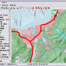
TNTmips 20240404 freeware

TNTmips is a geospatial image processing tool that allows you to analyze and modify GIS images. It is a professional application that can handle desktop cartography, electronic atlas preparation and spatial database management. ...

Author MicroImages, Inc.
Released 2024-04-04
Filesize 121.00 MB
Downloads 1695
OS Windows XP, Windows Vista, Windows Vista x64, Windows 7, Windows 7 x64, Windows 8, Windows 8 x64, Windows 10, Windows 10 x64, Windows 11
Installation Instal And Uninstall
Keywords GIS data analysis, analyze geodetic data, edit GIS dataset, GIS, dataset, editor, analysis
Users' rating
(120 rating)
TNTmipsCADWindows XP, Windows Vista, Windows Vista x64, Windows 7, Windows 7 x64, Windows 8, Windows 8 x64, Windows 10, Windows 10 x64, Windows 11
TNTmips - maps Freeware Download Notice

TNTmips Free Download - we do not host any TNTmips torrent files or links of TNTmips on rapidshare.com, depositfiles.com, megaupload.com etc. All TNTmips download links are direct TNTmips download from publisher site or their selected mirrors.

TNTmips freeware - The Latest User Reviews
TNTmips freeware - The Latest Versions History
20240404 Apr 4, 2024 New Release
20240131 Jan 31, 2024 New Release
20240108 Jan 8, 2024 New Release

Most popular CAD freeware downloads

Panoply for Mac

5.4.3 freeware download

... can project the analysis using more than 100 maps. What’s more, you get to overlay continent, or other types of masks on top of the ...

Gwyddion

2.66 freeware download

... color or material representation · easily editable color maps and OpenGL materials · basic operations: rotation, flipping, inversion, data arithmetic, crop, resampling · leveling: plane ...

TNTatlas

2024 B20240606 freeware download

... viewer that lets you publish and distribute your maps and geospatial data — from a single geodata ... part in the way we work and live. Maps, drawings, photos and related materials may be the ...

Elshayal Smart

23.02 freeware download

... independent of any commercial software package. Download Maps from Google Earth, and Trace & save GPS route and View and Rectify Raster Images gif, ...

Mobile Atlas Creator

2.2.1 freeware download

... applications please see the features section. Additionally individual maps can be exported as one large PNG image ... can use a large number of different online maps such as OpenStreetMap, Google Maps, Yahoo Maps and ...

JMARS

3.1.5 freeware download

... roughness data with thermal inertia data. * Contour maps may be created. * Groups of layers can ... THEMIS, Viking, and CTX; topography from MOLA; compositional maps from TES and GRS/HEND; albedo and thermal inertia ...

5 freeware award

QFitsView

8.6 freeware download

... experience with a variety of scaling options, color maps, and region definitions, enabling precise control over how data is presented. This flexibility is crucial for ...

ArcReader

10.5.0 B6491 freeware download

... that allows users to view, explore, and print maps and globes. Anyone with ArcReader can view high-quality interactive maps authored by a high-level ArcGIS for Desktop product ...

Gwyddion for Linux

2.66 freeware download

... color or material representation · easily editable color maps and OpenGL materials · basic operations: rotation, flipping, inversion, data arithmetic, crop, resampling · leveling: plane ...

ApE for Mac OS X

2.0.30 Alpha freeware download

... easy to use plasmid editor. Creates graphic restriction maps- linear or circular with features indicated. Connects graphic and text features with hyperlink double click. Saves ...