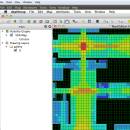
UCL Depthmap 0.8.0 freeware

Depthmap is a single software platform to perform a set of spatial network analyses designed to understand social processes within the built environment. It works at a variety of scales from building through small urban to whole cities or states. ...

Author University College London
Released 2020-11-08
Filesize 35.10 MB
Downloads 1391
OS Windows XP, Windows Vista, Windows Vista x64, Windows 7, Windows 7 x64, Windows 8, Windows 8 x64, Windows 10, Windows 10 x64, Windows 11
Installation Instal And Uninstall
Keywords urban environment, urban map, spatial network analysis, environment, map, analysis
Users' rating
(28 rating)
UCL DepthmapCADWindows XP, Windows Vista, Windows Vista x64, Windows 7, Windows 7 x64, Windows 8, Windows 8 x64, Windows 10, Windows 10 x64, Windows 11
UCL Depthmap - number Freeware Download Notice

UCL Depthmap Free Download - we do not host any UCL Depthmap torrent files or links of UCL Depthmap on rapidshare.com, depositfiles.com, megaupload.com etc. All UCL Depthmap download links are direct UCL Depthmap download from publisher site or their selected mirrors.

UCL Depthmap freeware - The Latest User Reviews
UCL Depthmap freeware - The Latest Versions History
0.8.0 Nov 8, 2020 New Release General:
Allow for pushing values from shapemaps (axial maps, segment maps) to VGA
Fix VGA map connections export
Make drawing to segment conversion faster
Test and fix shape removal for axial and data maps
Allow pushing the Ref or Key value to another layer
Fix MIF/MID import (allow for empty columns, PR #369)
Fix diagonal line handling on VGA map fill (PR #326, thanks Piotr Piastucki!)
Change C++ standard to 17
Graphical User Interface (GUI):
Highlight shapes and pixels on hover (can be disabled in the settings)
Allow inserting any number in the table (PR #356)
Fix a case where the app would crash with multiple unlinking in VGA (PR #328)
Fix convex map hover and selection (PR #368)
Allow generating multiple isovists by importing a CSV file
Fix a case where VGA progress bar would end, but analysis would still be going (PR #323)
0.7.0 Jun 7, 2019 New Release
0.30 Sep 18, 2014 New Release

Most popular CAD freeware downloads

Mobile Atlas Creator for Mac OS X

2.2.1 freeware download

... atlas Mobile Atlas Creator can use a large number of different online maps such as OpenStreetMap, Google ... Features: Create offline atlases for a large number of different (mobile) applications and GPS handhelds: AFTrack ...

QGIS for Mac

3.36.1 freeware download

... daily GIS data viewing needs. QGIS supports a number of raster and vector data formats, with new support easily added using the plugin architecture. ...

TinyCAD

3.00.04 freeware download

... use TinyCAD as a front end to a number of PCB layout program, by getting TinyCAD to create a netlist of your circuit. TinyCAD ...

EnCalc

4.2 freeware download

... completely re-sizable by dragging the corners New! Unlimited number of Loan Profiles * New! Use the +/= ... on NumLock * Decimal, Binary, Hexadecimal, and Octal number systems (with conversion) Printable, savable, and removable colored ...

Noble Ape Simulation

0.698 freeware download

The Noble Ape Simulation has been open source from the start. The source code for the current Noble Ape Simulation has been online under continuous development ...

Engauge Digitizer for Mac OS X

12.0 freeware download

... image file showing a graph or map, into numbers. The image file can come from a scanner, digital camera or screenshot. The numbers can be read on the screen, and written ...

5 freeware award

GstarCAD MC

3.3.1 freeware download

... Precise Drawing available, e.g., user can change the number of the coordinates to move the points precisely. • Support 2D absolute coordinates, relative coordinates and ...

Circular Layout

0.3 freeware download

... "high degree" nodes on outside circle. *Allows setting number of "high degree" nodes to use on second circle. *Allows drawing node order on circle either ...

Mobile Atlas Creator

2.2.1 freeware download

... atlas Mobile Atlas Creator can use a large number of different online maps such as OpenStreetMap, Google ... Features: Create offline atlases for a large number of different (mobile) applications and GPS handhelds: AFTrack ...

UCL Depthmap

0.8.0 freeware download

... used to assess the visual accessibility in a number of ways. It can produce point isovists, that ... an agent-based analysis. In the agent-based analysis a number of software agents representing pedestrians are released into ...