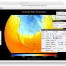
Panoply for Mac 5.4.3 freeware

Panoply for Mac is an utility that enable user to plot raster image. Depending on the data, it can draw global longitude-latitude images or pole-to-pole latitude-vertical images.Panoply is a cross-platform application which plots geo-gridded arrays from netCDF, HDF and GRIB datasets. The utility can also combine two arrays and can project the analysis using more than 100 maps. ...

Author Robert B. Schmunk
Released 2024-06-24
Filesize 36.40 MB
Downloads 897
OS Mac OS X
Installation Instal And Uninstall
Keywords plot raster image, longitude image, pole-to-pole image, raster image, rasterize, raster
Users' rating
(38 rating)
Panoply for MacCADMac OS X
Panoply for Mac - on line Freeware Download Notice

Panoply for Mac Free Download - we do not host any Panoply for Mac torrent files or links of Panoply for Mac on rapidshare.com, depositfiles.com, megaupload.com etc. All Panoply for Mac download links are direct Panoply for Mac download from publisher site or their selected mirrors.

Panoply for Mac freeware - The Latest User Reviews
Panoply for Mac freeware - The Latest Versions History
5.4.3 Jun 24, 2024 New Release
5.4.1 Jun 1, 2024 New Release
5.4.0 May 11, 2024 New Release

Most popular CAD freeware downloads

Panoply for Mac

5.4.3 freeware download

... arrays from 2D or larger multidimensional variables. Create line plots of data from 1D or larger multidimensional ... 200 map projections or make a zonal average line plot. Overlay continent outlines or masks on lon-lat ...

Rocket Propulsion Analysis Lite x64

1.2.0 freeware download

Rocket Propulsion Analysis (RPA) is a multi-platform rocket engine analysis tool for rocketry professionals, scientists, students and amateurs. For many years rocketry scientists, students and ...

SDMetrics

2.5 freeware download

... outliers, browse histograms and Kiviat charts. Command line interface: · The measurement and data export features are also accessible via a command line interface. Automated analysis runs allow you to integrate ...

Digimizer

6.4.0 freeware download

... unit of measurement measure distances and lengths of line segments or paths measure perimeters and areas measure angles locate middle of line segment find center and calculate characteristics of circular ...

Aqsis Renderer for Windows

1.8.2 freeware download

Open source 3D rendering solution adhering to the RenderMan standard Aqsis is a cross-platform photorealistic 3D rendering solution, adhering to the RenderMan interface standard ...

Aqsis Renderer for Mac OS X

1.8.2 freeware download

Open source 3D rendering solution adhering to the RenderMan standard Aqsis for Mac OS X is a cross-platform photorealistic 3D rendering solution, adhering to ...

Gwyddion

2.66 freeware download

... logarithmical, gradient- and edge-detected, local contrast representation, Canny lines · OpenGL 3D data display: false color or ... facet leveling, polynomial background removal, leveling along user-defined lines · value reading, distance and angle measurement · ...

UCL Depthmap

0.8.0 freeware download

... segment maps, or segment maps, such as road-centre line maps, may be imported directly. These may be ... MapInfo MIF / MID import · OpenStreetMap, Tiger Line and Ordnance Survey ITN layer loaders · Text, ...

DSI Studio

.59 freeware download

... Coregistration: · Insert T1/T2 images in tractography by linear transform with mutual information as cost function. Visualization: · Real time 3D tractography presentation · ...

Euler Math Toolbox

2024-01-14 freeware download

... product and residuum calculation, · exact solutions of linear systems, · data type for sparse matrices, ... of Basic, · multiple function results, · one line functions for simple functions, · access to global ...