Open3DQSAR for Mac OS X 2.24 freeware

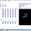
Open3DQSAR is an open-source tool aimed at pharmacophore exploration by high-throughput chemometric analysis of molecular interaction fields (MIFs). Open3DQSAR can generate steric potential, electron density and MM/QM electrostatic potential fields; furthermore, it can import GRIDKONT binary files produced by GRID and CoMFA/CoMSIA fields (exported from SYBYL with the aid of a small SPL script). ...

Author Paolo Tosco
Released 2013-06-20
Filesize 1.10 MB
Downloads 566
OS Mac OS X
Installation Instal And Uninstall
Keywords chemometric analysis, analyze MIF, pharmacophore exploration, MIF, analysis, chemometry
Users' rating
(11 rating)
Open3DQSAR for Mac OS XCADMac OS X
Open3DQSAR for Mac OS X - plots Freeware Download Notice

Open3DQSAR for Mac OS X Free Download - we do not host any Open3DQSAR for Mac OS X torrent files or links of Open3DQSAR for Mac OS X on rapidshare.com, depositfiles.com, megaupload.com etc. All Open3DQSAR for Mac OS X download links are direct Open3DQSAR for Mac OS X download from publisher site or their selected mirrors.

Open3DQSAR for Mac OS X freeware - The Latest User Reviews
Open3DQSAR for Mac OS X freeware - The Latest Versions History
2.24 Jun 20, 2013 New Release · A bug which caused abrupt program exit when PyMOL was closed while Open3DQSAR was still running was fixed
· Linking against libminizip is now optional
2.23 Jan 25, 2013 New Release · A bug in the import type=DEPENDENT keyword which caused an error message whenever attempting to import multiple dependent variables was fixed
2.22 Jan 4, 2013 New Release · The new type=MOE_GRID parameter was added to the prepare keyword to allow preparing a shape vector for the computation of interaction potentials within MOE using the same grid box settings as defined in Open3DQSAR
· The new type=MOE_GRID parameter was added to the import keyword to allow importing in Open3DQSAR the interaction potential grids computed within MOE
· The WriteMOEGRID.svl SVL script has been added to the util folder
· Minor bugfixes all over

Most popular CAD freeware downloads

Panoply for Mac

5.4.3 freeware download

Panoply for Mac is a cross-platform application which plots geo-gridded arrays from netCDF, HDF and GRIB datasets. ... types of databases, in order to generate geo-gridded plots. Since the application deploys on the Java Runtime, ...

GProX

1.1.16 freeware download

... of data distributions as: · Heatmaps · Scatter plots · Histograms · Box plots ...

Engauge Digitizer for Linux

12.0 freeware download

... Features: * Automatic curve tracing of line plots * Automatic point matching of point plots * Automatic axes matching * Automatic grid line ...

SCaVis

2.3 freeware download

... output graphics for data and function visualization. All plots can be exported to raster formats (PDF, PNG, JPG, etc.) and high-quality vector formats (PostScript, EPS) ...

5 freeware award

MagicPlot Student for Mac OS X

2.9.3 freeware download

... Data processing - Multiple axes - Color map plots - Figure templates - Batch processing ...

Myrtle for Linux

1.9.0 freeware download

... available. Students can easily create, customize, and update plots and graphical summaries of their analyses. Myrtle offers a unique bookmarking facility which allows ...

Gwyddion

2.66 freeware download

... area under arbitrary mask · row/column statistical quantities plots · ISO roughness parameter evaluation · grains: threshold marking and unmarking, watershed marking · grain statistics: ...

Engauge Digitizer for Windows

12.0 freeware download

... Features: * Automatic curve tracing of line plots * Automatic point matching of point plots * Automatic axes matching * Automatic grid line ...

5 freeware award

Engauge Digitizer for Mac OS X

12.0 freeware download

... Features: * Automatic curve tracing of line plots * Automatic point matching of point plots * Automatic axes matching * Automatic grid line ...

5 freeware award

JMARS for Windows

3.1.5 freeware download

... transparency blending or building an HSV/RGB composite. * Plots may be created by drawing multi-segment lines on the map, making it easy to sample elevation, ...