Thuban for Linux 1.2.2 freeware

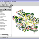
... Support: Shapefile, PostGIS Layer and OGR
# Raster Data Support: GeoTIFF Layer and GDAL
# Comfortable Map Navigation
# Object Identification and Annotation
# Legend Editor and Classification
# Table Queries and Joins
# Projection Support
# Printing and Vector Export
# API for Add-Ons (Extensions) ...

Author Thuban Development Team
Released 2009-08-18
Filesize 1.18 MB
Downloads 389
OS Linux
Installation Instal And Uninstall
Keywords geographic data viewer, gis viewer, analyze geographic information, information, geographic, viewer
Users' rating
(9 rating)
Thuban for LinuxCADLinux
Thuban for Linux - raster Freeware Download Notice

Thuban for Linux Free Download - we do not host any Thuban for Linux torrent files or links of Thuban for Linux on rapidshare.com, depositfiles.com, megaupload.com etc. All Thuban for Linux download links are direct Thuban for Linux download from publisher site or their selected mirrors.

Thuban for Linux freeware - The Latest User Reviews
Thuban for Linux freeware - The Latest Versions History
1.2.2 Aug 18, 2009 New Release

Most popular CAD freeware downloads

Panoply for Mac

5.3.4 freeware download

Panoply for Mac is a cross-platform application which plots geo-gridded arrays from netCDF, HDF and GRIB datasets. Panoply is designed to help you view and process ...

TNTmips for Mac OS X

20240111 freeware download

... Import and export an unsurpassed number of raster, geometric, and database file formats; convert between data ... Contouring, and Triangulation operations produce Digital Elevation Model rasters (DEMs), contour lines, and triangulated irregular networks (TINs), ...

QGIS for Mac

3.36.2 freeware download

... Open Source Software (FOSS). QGIS supports vector, raster, and database formats and lets you browse and ... data viewing needs. QGIS supports a number of raster and vector data formats, with new support easily ...

New Version

QGIS for Linux

3.36.2 freeware download

... Open Source Software (FOSS). QGIS supports vector, raster, and database formats and lets you browse and ... data viewing needs. QGIS supports a number of raster and vector data formats, with new support easily ...

New Version

QGIS

3.36.2 freeware download

... Open Source Software (FOSS). QGIS supports vector, raster, and database formats and lets you browse and ... data viewing needs. QGIS supports a number of raster and vector data formats, with new support easily ...

New Version

TNTmips

20240404 freeware download

... Import and export an unsurpassed number of raster, geometric, and database file formats; convert between data ... Contouring, and Triangulation operations produce Digital Elevation Model rasters (DEMs), contour lines, and triangulated irregular networks (TINs), ...

Panoply

5.3.4 freeware download

... application whose purpose is to help you plot raster images. It lets you view photos created with ... software application that helps you plot and analyze raster images of geo-gridded data from NetCDF and other ...

BabaCAD

2.0.0 freeware download

... (jpg, bmp, gif,...) Insert and manage georeferenced raster images (tif/tfw,jpg/jgw,bmp/bpw) Fast OpenGL graphics used for rendering BabaCAD runs fast even on older ...

Elshayal Smart

23.02 freeware download

... & save GPS route and View and Rectify Raster Images gif, jpg, bmp and Edit shape files, build new layer, add existing layer, remove layers, ...

ShareCAD

2.0 freeware download

... STEP, STP, IGES, IGS, BREP, STL, SAT (ACIS); Raster formats: PNG, BMP, JPG, GIF, TIFF, TGA, CAL; Archives: 7z, RAR, CAB, ZIP, BZIP, TAR. ShareCAD ...