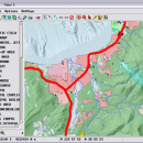
TNTmips 20240404 freeware

TNTmips is a geospatial image processing tool that allows you to analyze and modify GIS images. It is a professional application that can handle desktop cartography, electronic atlas preparation and spatial database management. ...

Author MicroImages, Inc.
Released 2024-04-04
Filesize 121.00 MB
Downloads 1745
OS Windows XP, Windows Vista, Windows Vista x64, Windows 7, Windows 7 x64, Windows 8, Windows 8 x64, Windows 10, Windows 10 x64, Windows 11
Installation Instal And Uninstall
Keywords GIS data analysis, analyze geodetic data, edit GIS dataset, GIS, dataset, editor, analysis
Users' rating
(121 rating)
TNTmipsCADWindows XP, Windows Vista, Windows Vista x64, Windows 7, Windows 7 x64, Windows 8, Windows 8 x64, Windows 10, Windows 10 x64, Windows 11
TNTmips - system tools Freeware Download Notice

TNTmips Free Download - we do not host any TNTmips torrent files or links of TNTmips on rapidshare.com, depositfiles.com, megaupload.com etc. All TNTmips download links are direct TNTmips download from publisher site or their selected mirrors.

TNTmips freeware - The Latest User Reviews
TNTmips freeware - The Latest Versions History
20240404 Apr 4, 2024 New Release
20240131 Jan 31, 2024 New Release
20240108 Jan 8, 2024 New Release

Most popular CAD freeware downloads

DipTrace Free

4.3.0.0 freeware download

... Layout features a shape-based autorouter, high-speed/differential signal routing tools and 3D PCB Preview/Export. Schematic Capture works with ... your design. DipTrace provides manual and automatic placement tools and is capable of routing single- and multilayer ...

TNTmips

20240404 freeware download

TNTmips software is a complete Geographic Information System (GIS) that lets you work with virtually any ... with associated database attributes. It provides all the tools you need to view, create, edit, georeference, interpret, ...

Graph Streaming

0.7.0.12 freeware download

... leverage its power to visualize and monitor complex systems or enterprise data in real-time. Moreover, the idea ... standardized API could bring interoperability with other available tools for graph and network analysis, as they could ...

JMARS

3.1.5 freeware download

... for Remote Sensing. It is a geospatial information system (GIS) developed by ASU's Mars Space Flight Facility to provide mission planning and data-analysis tools to NASA's orbiters, instrument team members, students of ...

5 freeware award

QGIS for Mac

3.36.1 freeware download

... Improved vector and attribute editing · Improved measure tools with area measuring · Attribute searching · New legend structure · Refactoring of API to allow ...

Axdea 3D CAD, BIM based IBS Score

1.1.6 freeware download

... Malaysia. Axdea is specially customised for IBS Scoring system based on the Malaysian Construction Industry Standard. As ... software with the following features:- 1) IBS Scoring System: Automatic calculation of IBS score based on the ...

QGIS for Linux

3.36.1 freeware download

... Improved vector and attribute editing · Improved measure tools with area measuring · Attribute searching · New legend structure · Refactoring of API to allow ...

Axdea

1.1.6 freeware download

... Lumpur, Malaysia. Axdea is customised for IBS Scoring system based on the Malaysian Construction Industry Standard. As ... software with the following features:- 1) IBS Scoring System: Automatic calculation of IBS score based on the ...

QGIS

3.36.1 freeware download

... Improved vector and attribute editing · Improved measure tools with area measuring · Attribute searching · New legend structure · Refactoring of API to allow ...

JMARS for Windows

3.1.5 freeware download

... for Remote Sensing. It is a geospatial information system (GIS) developed by ASU's Mars Space Flight Facility to provide mission planning and data-analysis tools to NASA's orbiters, instrument team members, students of ...