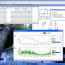
SimThyr for Mac OS X 4.0.0.837 freeware

SimThyr is a simulation program for the pituitary thyroid feedback control that is based on a parametrically isomorphic model of the overall system. Applications of this program cover research, including development of hypotheses, and education of students in biology and medicine, nurses and patients. ...

Author Johannes W. Dietrich
Released 2015-04-27
Filesize 7.30 MB
Downloads 1153
OS Mac OS X
Installation Instal And Uninstall
Keywords hypothesis development, biology simulation, simulation tool, simulation, simulate, simulator
Users' rating
(37 rating)
SimThyr for Mac OS XCADMac OS X
Our rating 5 freeware award
SimThyr for Mac OS X - tool for Freeware Download Notice

SimThyr for Mac OS X Free Download - we do not host any SimThyr for Mac OS X torrent files or links of SimThyr for Mac OS X on rapidshare.com, depositfiles.com, megaupload.com etc. All SimThyr for Mac OS X download links are direct SimThyr for Mac OS X download from publisher site or their selected mirrors.

SimThyr for Mac OS X freeware - The Latest User Reviews
SimThyr for Mac OS X freeware - The Latest Versions History
4.0.0.837 Apr 27, 2015 New Release Milestone 4.0 (Merlion):
Major re-write of simulator engine, addition of null isocline plots, enhanced data export options and model annotations
4.0: First version of SimThyr 4 featuring nullcline plots, numeric export options and support for MIRIAM-compliant models (SVN commits 262 to 288 and 296 to 401, 13-IV-2017).
3.3.3.482 Apr 27, 2015 New Release Bug fixes for structure parameters editor (SVN commits r289 to r293, 13-IV-2015).
3.3.2.482 Apr 27, 2015 New Release Bug fixes for structure parameters editor (SVN commits r289 to r293, 13-IV-2015).

Most popular CAD freeware downloads

Model Air Design

2.5 freeware download

Model Aircraft Design software for Windows PC. Model Air Design is the new, ... to create airplane models. It's a modern software tool for model aircraft design. Model Air Design is ...

pCon.planner

8.9.0.100 freeware download

... try to see how useful it can be for 3D design! Please note: pCon.planner 8.1 will ... Measuring height of any selected object - Support for the drawing element "cylinder" for 3D operations - ...

EQAlign

2.3.7 freeware download

... CCD and CMOS cams. EQAlign is available for Windows systems, we are working in a Linux version called Kalyke. EQAlign is free software published ...

JMARS

3.1.5 freeware download

JMARS is an acronym that stands for Java Mission-planning and Analysis for Remote Sensing. It is a geospatial information system ... Flight Facility to provide mission planning and data-analysis tools to NASA's orbiters, instrument team members, students of ...

5 freeware award

p3d

2.6.2 freeware download

p3d is a general data-reduction tool that is intended to be used with data of fiber-fed integral field spectrographs (IFSs). This tool can be useful for people who have access ...

FilterPro Desktop

3.1.0.23446 freeware download

... to Excel. FilterPro active filter design tool allows designers to create and edit active filter ... active filter design software is free and available for download now. FilterPro v3.1 Active Filter Design ...

JMARS for Windows

3.1.5 freeware download

JMARS is an acronym that stands for Java Mission-planning and Analysis for Remote Sensing. It is a geospatial information system ... Flight Facility to provide mission planning and data-analysis tools to NASA's orbiters, instrument team members, students of ...

QGIS for Mac

3.36.1 freeware download

... its evolution and is being used by many for their daily GIS data viewing needs. QGIS supports ... some key features of "QGIS": · Support for spatially enabled PostgreSQL tables using PostGIS · Support ...

MicroDicom x64

2024.2 freeware download

MicroDicom x64 is application for primary processing and preservation of medical images in DICOM format. It is equipped with most common tools for manipulation of DICOM images and it has ...

TNTmips

20240404 freeware download

... with associated database attributes. It provides all the tools you need to view, create, edit, georeference, interpret, ... type of geospatial data. TNTmips provides professional geospatial tools in a single package at an affordable price ...