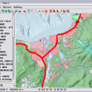
TNTmips 20240131 freeware

TNTmips is a geospatial image processing tool that allows you to analyze and modify GIS images. It is a professional application that can handle desktop cartography, electronic atlas preparation and spatial database management. ...

Author MicroImages, Inc.
Released 2024-01-31
Filesize 121.00 MB
Downloads 1563
OS Windows XP, Windows Vista, Windows Vista x64, Windows 7, Windows 7 x64, Windows 8, Windows 8 x64, Windows 10, Windows 10 x64, Windows 11
Installation Instal And Uninstall
Keywords GIS data analysis, analyze geodetic data, edit GIS dataset, GIS, dataset, editor, analysis
Users' rating
(91 rating)
TNTmipsCADWindows XP, Windows Vista, Windows Vista x64, Windows 7, Windows 7 x64, Windows 8, Windows 8 x64, Windows 10, Windows 10 x64, Windows 11
TNTmips - view image Freeware Download Notice

TNTmips Free Download - we do not host any TNTmips torrent files or links of TNTmips on rapidshare.com, depositfiles.com, megaupload.com etc. All TNTmips download links are direct TNTmips download from publisher site or their selected mirrors.

TNTmips freeware - The Latest User Reviews
TNTmips freeware - The Latest Versions History
20240131 Jan 31, 2024 New Release
20240108 Jan 8, 2024 New Release
20231103 Nov 3, 2023 New Release

Most popular CAD freeware downloads

MarvinSketch

23.16.0 freeware download

... Chemical structure drawing Molecular modeling Tune, combine and view Predictors and enumerators Structure and valence checker Working with abbreviated groups Image generation, display and formatting ...

Panoply for Mac

5.3.3 freeware download

... GRIB datasets. Panoply is designed to help you view and process the data included in netCDF, HDF, ... to disk GIF, JPEG, PNG or TIFF bitmap images or as PDF or PostScript graphics files. Export ...

TNTmips for Mac OS X

20240111 freeware download

... with virtually any type of geospatial data including imagery, terrain surfaces, and map data with associated database ... It provides all the tools you need to view, create, edit, georeference, interpret, and publish any type ...

Panoply

5.3.3 freeware download

... whose purpose is to help you plot raster images. It lets you view photos created with NetCDF, HDF, GEMPACK, GRIB and ... application that helps you plot and analyze raster images of geo-gridded data from NetCDF and other datasets. ...

Br3D

1.3 freeware download

Light weight, fast free 3D ViewerLight weight, fast free 3D Viewer Supports various 3D file format. Read : DWG, ... STP, STL, IGES, IGS, PRC, XML Mouse control View Rotation : Control Key + Mouse Wheel Button ...

TNTmips

20240131 freeware download

... with virtually any type of geospatial data including imagery, terrain surfaces, and map data with associated database ... It provides all the tools you need to view, create, edit, georeference, interpret, and publish any type ...

Sweet Home 3D

7.2 freeware download

... draw the walls of your home upon the image of an existing plan, change the color or ... 2D plan are simultaneously reflected in a 3D view, and you can navigate in it either from ...

GelAnalyzer

23.1.1 freeware download

... to help you with the 1D gel electrophoresis image analysis. The process of gel image analysis is straightforward and covers all the main ...

LiverSegm

0.5.1 Beta freeware download

... has been developed with the processing of liver images in mind. This software implements a level set based variational approach that incorporates shape priors and ...

VEGA ZZ

3.2.3.28 freeware download

... hardware anti-aliasing, material management, 3D backgrounds. Stereo view (shutter or anaglyphic glasses). 10 bit output for each color channel for a smoother view (230 = 1.073.741.824 vs. 224 = 16.777.216 colors). ...