Navigation:
- Freeware
- - Graphic Apps
- - CAD
- - QGIS for Mac
QGIS for Mac 3.36.1 freeware
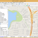
... database formats and lets you browse and create map data on your computer.
QGIS supports many ... initial goal was to provide a GIS data viewer. ...
| Author | Gary Sherman |
| Released | 2024-03-26 |
| Filesize | 1600.00 MB |
| Downloads | 824 |
| OS | Mac OS X |
| Installation | Instal And Uninstall |
| Keywords | geographic information system, map creator, map viewer, GIS, geographic information, create, QGIS for Mac |
| Users' rating (36 rating) |
QGIS for Mac Free Download - we do not host any QGIS for Mac torrent files or links of QGIS for Mac on rapidshare.com, depositfiles.com, megaupload.com etc. All QGIS for Mac download links are direct QGIS for Mac download from publisher site or their selected mirrors.
| 3.36.1 | Mar 26, 2024 | New Release | |
| 3.36.2 | Apr 25, 2024 | New Release | |
| 3.36.1 | Mar 26, 2024 | New Release |


