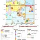
TNTatlas 2024 B20240606 freeware

TNTatlas is a powerful free geodata viewer that lets you publish and distribute your maps and geospatial data — from a single geodata file to complex map layouts prepared using TNTmips. TNTatlas lets you display massive sized geodata and will directly display numerous file formats including shapefiles, GeoTIFF, JP2, PNG, MrSID, DXF, and DWG. ...

Author MicroImages, Inc.
Released 2024-06-06
Filesize 59.00 MB
Downloads 2454
OS Windows XP, Windows Vista, Windows Vista x64, Windows 7, Windows 7 x64, Windows 8, Windows 8 x64, Windows 10, Windows 10 x64, Windows 11
Installation Instal And Uninstall
Keywords geospatial viewer, view atlas, visualize geospatial data, atlas, map, viewer
Users' rating
(70 rating)
TNTatlasCADWindows XP, Windows Vista, Windows Vista x64, Windows 7, Windows 7 x64, Windows 8, Windows 8 x64, Windows 10, Windows 10 x64, Windows 11
TNTatlas - viewer Freeware Download Notice

TNTatlas Free Download - we do not host any TNTatlas torrent files or links of TNTatlas on rapidshare.com, depositfiles.com, megaupload.com etc. All TNTatlas download links are direct TNTatlas download from publisher site or their selected mirrors.

TNTatlas freeware - The Latest User Reviews
TNTatlas freeware - The Latest Versions History
2024 B202406 Jun 6, 2024 New Release
2022 B202212 Dec 7, 2022 New Release
2022 B202211 Nov 30, 2022 New Release

Most popular CAD freeware downloads

Panoply for Mac

5.4.3 freeware download

Panoply for Mac is a cross-platform application which plots geo-gridded arrays from netCDF, HDF and GRIB datasets. Panoply is designed to help you view and process ...

GGCad Free Edition

2.1.0.5 freeware download

GGCad includes an advanced user interface. It is made up of windows that can be moved, detached at the user's convenience. The size and icon transparency, ...

ANTz

2019-03-18 freeware download

ANTz was developed as an interactive and real-time 3D data viewing instrument for the cognizance of complex systems. Think of it as 'spreadsheet meets cyberspace.' ...

TNTatlas

2024 B20240606 freeware download

TNTatlas is a powerful free geodata viewer that lets you publish and distribute your maps and geospatial data — from a single geodata file to ...

DipTrace Free

4.3.0.0 freeware download

DipTrace is an advanced PCB design software that consists of 4 modules: PCB Layout, Schematic Capture, Component and Pattern Editors. This EDA tool is a perfect ...

Qualyzer

1.2.1 freeware download

Qualyzer is a handy, easy to use application designed to support researchers conducting qualitative inquiries by helping them manage participants, transcripts, and memos. ...

Melanie Viewer

7.0.7 freeware download

... tools to the international scientific community. The Melanie Viewer 7.0 is one of these tools. This Viewer is made available free of charge to help ... an appropriate format (.tif, .gel, etc.). The Viewer includes similar functionalities as the full versions of ...

LiverSegm

0.5.1 Beta freeware download

LiverSegm has been developed with the processing of liver images in mind. This software implements a level set based variational approach that incorporates shape priors and ...

Kst for Linux

2.0.7 freeware download

Kst is the fastest real-time large-dataset viewing and plotting tool available (you may be interested in some benchmarks) and has built-in data analysis functionality. Kst is ...

Thuban for Windows

1.2.2 freeware download

Thuban is an interactive geographic data viewer (GIS viewer) which features methods to visualize, explore, and analyze ... information. Thuban is an Interactive Geographic Data Viewer with the following features: # Vector Data ...