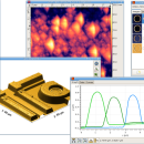
Gwyddion 2.66 freeware

... for SPM (scanning probe microscopy) data visualization and analysis. Primarily it is intended for analysis of height fields obtained by scanning probe microscopy ... used for any other height field and image analysis, for instance for analysis of profilometry data (learn more about Gwyddion features). ...

Author David Necas and Petr Klapetek
Released 2024-05-26
Filesize 25.10 MB
Downloads 1751
OS Windows XP, Windows Vista, Windows Vista x64, Windows 7, Windows 7 x64, Windows 8, Windows 8 x64, Windows 10, Windows 10 x64, Windows 11
Installation Instal And Uninstall
Keywords data visualization, data analysis, height field analysis, analyze, visualize, visualizer
Users' rating
(43 rating)
GwyddionCADWindows XP, Windows Vista, Windows Vista x64, Windows 7, Windows 7 x64, Windows 8, Windows 8 x64, Windows 10, Windows 10 x64, Windows 11
Gwyddion - analysis Freeware Download Notice

Gwyddion Free Download - we do not host any Gwyddion torrent files or links of Gwyddion on rapidshare.com, depositfiles.com, megaupload.com etc. All Gwyddion download links are direct Gwyddion download from publisher site or their selected mirrors.

Gwyddion freeware - The Latest User Reviews
Gwyddion freeware - The Latest Versions History
2.66 May 26, 2024 New Release
2.65 Jan 4, 2024 New Release
2.64 Oct 29, 2023 New Release

Most popular CAD freeware downloads

Panoply for Mac

5.4.3 freeware download

... also combine two arrays and can project the analysis using more than 100 maps. What’s more, you get to overlay continent, or other types of ...

JMARS

3.1.5 freeware download

... an acronym that stands for Java Mission-planning and Analysis for Remote Sensing. It is a geospatial information system (GIS) developed by ASU's Mars Space Flight ...

5 freeware award

QXRD

0.11.10.16 freeware download

QXRD is software for the acquisition and analysis of X-ray data taken with 2 dimensional detectors. The software can drive a Perkin Elmer XRD series ...

JMARS for Windows

3.1.5 freeware download

... an acronym that stands for Java Mission-planning and Analysis for Remote Sensing. It is a geospatial information system (GIS) developed by ASU's Mars Space Flight ...

Graph Streaming

0.7.0.12 freeware download

... with other available tools for graph and network analysis, as they could start to interoperate with other tools in a distributed and cooperative fashion. ...

QGIS for Mac

3.36.1 freeware download

... files · GRASS integration, including view, edit, and analysis · On the fly projection of vector layers · Map composer · Identify features · Display ...

GeoMapApp

3.7.1 freeware download

... display customization and analytical tools to support the analysis of multidisciplinary data sets. Choose from Mercator, North ... Several custom portals provide visualization and basic analysis for data types that typically require specialist software. ...

TNTmips

20240404 freeware download

TNTmips software is a complete Geographic Information System (GIS) that lets you work with virtually any type of geospatial data including imagery, terrain surfaces, and map ...

QGIS for Linux

3.36.1 freeware download

... files · GRASS integration, including view, edit, and analysis · On the fly projection of vector layers · Map composer · Identify features · Display ...

QFitsView

8.6 freeware download

... to handle the complex demands of astronomical data analysis, DS9 offers a comprehensive suite of features that ... overlay of multiple data sets, allowing for comparative analysis and enhanced data interpretation. DS9 also offers ...