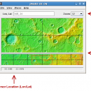
JMARS for Windows 3.1.5 freeware

JMARS is an acronym that stands for Java Mission-planning and Analysis for Remote Sensing. It is a geospatial information system (GIS) developed by ASU's Mars Space Flight Facility to provide mission planning and data-analysis tools to NASA's orbiters, instrument team members, students of all ages, and the general public. ...

Author Arizona State University
Released 2014-08-12
Filesize 50.00 MB
Downloads 589
OS Windows Vista, Windows Vista x64, Windows 7, Windows 7 x64
Installation Instal And Uninstall
Keywords mission analysis, geospatial information, GIS analysis, mission, analysis, GIS
Users' rating
(26 rating)
JMARS for WindowsCADWindows Vista, Windows Vista x64, Windows 7, Windows 7 x64
JMARS for Windows - freeware for mac Freeware Download Notice

JMARS for Windows Free Download - we do not host any JMARS for Windows torrent files or links of JMARS for Windows on rapidshare.com, depositfiles.com, megaupload.com etc. All JMARS for Windows download links are direct JMARS for Windows download from publisher site or their selected mirrors.

JMARS for Windows freeware - The Latest User Reviews
JMARS for Windows freeware - The Latest Versions History
3.1.5 Aug 12, 2014 New Release - In JMARS, locate the "Options" tab at the top of the screen, click it
- Click "Check for Updates"
3.0.4 Jun 7, 2013 New Release - minor change that will allow users to use Body->reset layers to reset layers to JMARS default/startup state
- minor bug fix in the interaction of the Main view and Panner views
- accuracy of crater layer settings improved when saving crater layers as part of a saved session
- more graceful error handling when loading a saved session
- removed the ESRI option from the list for loading/saving in the shape layer. The Geo tools ESRI option is the replacement
- a fix for a drawing issue in the TES layer on Mac OS X running Java 7
- lower right corner coordinates added to the high resolution export tool including new UI functionality for setting export height and width
- update to how image corners (lat/lon) are specified in high resolution export
- added CSV export and look and feel changes to the Investigate tool
- improved communication between the Stamp Layer and backend databases
- Add Layer UI look and feel improvements
- ease of use changes to crater counting layer for small bodies

Most popular CAD freeware downloads

Panoply for Mac

5.4.3 freeware download

Panoply for Mac is a cross-platform application which plots geo-gridded arrays ... map plots. Use any of numerous color tables for the scale colorbar, or apply your own custom ...

Aqsis Renderer for Mac OS X

1.8.2 freeware download

... adhering to the RenderMan standard Aqsis for Mac OS X is a cross-platform photorealistic 3D rendering ... comprehensive list of features that are considered necessary for production use, the following list details some of ...

TinyQuant

1.55 freeware download

A miniature utility for gel image analysis. Useful for integrating densities of gel bands in 16 bit greyscale (PC or Mac format ".gel" or TIFF files) or 24 bit ...

SolveDiffEq for Mac

3.6.0.0 freeware download

... integral. Your script is translated into machine language for fast calculation. ...

MedINRIA for Mac OS X

3.2.0 freeware download

... lot of features concerning medical image analysis, especially for DTI analysis and fiber tracking, but also some extra tools for tensor visualization and fMRI studies. A simple image ...

MagicPlot Calculator for Mac OS X

1.1 freeware download

MagicPlot Calculator is a free scientific formula calculator from MagicPlot graphing application. A fast and usable calculator to compute complex formulas! Features: Syntax highlighting ...

FreeDiams for Mac OS X

1.0.0 freeware download

... mainly developed by medical doctors and is intended for use by these same professionals. It can be ... before the version 0.0.10, to FreeDiams which stands for: Free Drugs InterActions Manager and preScriptor. FreeDiams ...

Mobile Atlas Creator for Mac OS X

2.2.1 freeware download

... open source (GPL) program which creates offline atlases for GPS handhelds and cell phone applications like TrekBuddy, ... other Android and WindowsCE based applications. For the full list of supported applications please see ...

Balancer Lite for Mac OS X

2.1.0.448 freeware download

... but works with small meshes only. The limits for a single mesh are 15000 triangles and 10000 ... Wavefront .obj. Balancer Lite can be used for non-commercial purposes in non-business, non-commercial environment only. Commercially, ...

PAST for Mac OS X

4.03 freeware download

Past is free software for scientific data analysis, with functions for data manipulation, plotting, univariate and multivariate statistics, ecological ...