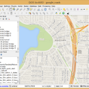
QGIS for Mac 3.36.1 freeware

QGIS supports vector, raster, and database formats and lets you browse and create map data on your computer.
QGIS supports many common spatial data formats (e.g. ESRI ShapeFile, geotiff). QGIS supports plugins to do things like display tracks from your GPS.
QGIS aims to be an easy to use GIS, providing common functions and features. The initial goal was to provide a GIS data viewer. ...

Author Gary Sherman
Released 2024-03-26
Filesize 1600.00 MB
Downloads 695
OS Mac OS X
Installation Instal And Uninstall
Keywords geographic information system, map creator, map viewer, GIS, geographic information, create, QGIS for Mac
Users' rating
(22 rating)
QGIS for MacCADMac OS X
QGIS for Mac - information analysis Freeware Download Notice

QGIS for Mac Free Download - we do not host any QGIS for Mac torrent files or links of QGIS for Mac on rapidshare.com, depositfiles.com, megaupload.com etc. All QGIS for Mac download links are direct QGIS for Mac download from publisher site or their selected mirrors.

QGIS for Mac freeware - The Latest User Reviews
QGIS for Mac freeware - The Latest Versions History
3.36.1 Mar 26, 2024 New Release
3.34.4 Feb 28, 2024 New Release
3.34.3 Jan 22, 2024 New Release

Most popular CAD freeware downloads

TNTmips for Mac OS X

20240111 freeware download

TNTmips for Mac is a complete Geographic Information System (GIS) that lets you work with virtually ... of natural terrains and mathematical surfaces from 3D information. Fast and efficient Surface Fitting, Contouring, and Triangulation ...

QGIS for Mac

3.36.1 freeware download

... files · GRASS integration, including view, edit, and analysis · On the fly projection of vector layers · Map composer · Identify features · Display ...

QGIS for Linux

3.36.1 freeware download

... files · GRASS integration, including view, edit, and analysis · On the fly projection of vector layers · Map composer · Identify features · Display ...

TNTmips

20240404 freeware download

TNTmips software is a complete Geographic Information System (GIS) that lets you work with virtually ... of natural terrains and mathematical surfaces from 3D information. Fast and efficient Surface Fitting, Contouring, and Triangulation ...

QGIS

3.36.1 freeware download

... files · GRASS integration, including view, edit, and analysis · On the fly projection of vector layers · Map composer · Identify features · Display ...

UCL Depthmap

0.8.0 freeware download

... example, intervisibility or overlap) and then perform graph analysis of the resulting network. The objective of the analysis is to derive variables which may have social ...

Qualyzer

1.2.1 freeware download

Qualyzer is a handy, easy to use application designed to support researchers conducting qualitative inquiries by helping them manage participants, transcripts, and memos. ...

DWSIM

6.6.2 freeware download

... Refluxed and Reboiled Absorbers. DWSIM also provides special information about the simulation and different means of inputting ... Characterization, Reactions Manager and User Component Creator Process Analysis and Optimization: Sensitivity Analysis Utility, Multivariate Optimizer with ...

OpenRocket

14.06 freeware download

... CP position Real-time flight altitude, velocity and acceleration information from a continuous simulation performed in the background ... of components or stages separately Simulation and analysis Full six degree of freedom simulation Rocket ...

DSI Studio

.59 freeware download

... boosted by multi-core CPU or distributed computing. Analysis: · ROI based analysis: able to export the FA value, fiber directions ... or MAT files (for Matlab) · Track specific analysis: able to obtain FA values according to track ...