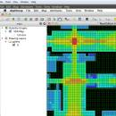
UCL Depthmap 0.8.0 freeware

Depthmap is a single software platform to perform a set of spatial network analyses designed to understand social processes within the built environment. It works at a variety of scales from building through small urban to whole cities or states. ...

Author University College London
Released 2020-11-08
Filesize 35.10 MB
Downloads 1402
OS Windows XP, Windows Vista, Windows Vista x64, Windows 7, Windows 7 x64, Windows 8, Windows 8 x64, Windows 10, Windows 10 x64, Windows 11
Installation Instal And Uninstall
Keywords urban environment, urban map, spatial network analysis, environment, map, analysis
Users' rating
(33 rating)
UCL DepthmapCADWindows XP, Windows Vista, Windows Vista x64, Windows 7, Windows 7 x64, Windows 8, Windows 8 x64, Windows 10, Windows 10 x64, Windows 11
UCL Depthmap - information analysis Freeware Download Notice

UCL Depthmap Free Download - we do not host any UCL Depthmap torrent files or links of UCL Depthmap on rapidshare.com, depositfiles.com, megaupload.com etc. All UCL Depthmap download links are direct UCL Depthmap download from publisher site or their selected mirrors.

UCL Depthmap freeware - The Latest User Reviews
UCL Depthmap freeware - The Latest Versions History
0.8.0 Nov 8, 2020 New Release General:
Allow for pushing values from shapemaps (axial maps, segment maps) to VGA
Fix VGA map connections export
Make drawing to segment conversion faster
Test and fix shape removal for axial and data maps
Allow pushing the Ref or Key value to another layer
Fix MIF/MID import (allow for empty columns, PR #369)
Fix diagonal line handling on VGA map fill (PR #326, thanks Piotr Piastucki!)
Change C++ standard to 17
Graphical User Interface (GUI):
Highlight shapes and pixels on hover (can be disabled in the settings)
Allow inserting any number in the table (PR #356)
Fix a case where the app would crash with multiple unlinking in VGA (PR #328)
Fix convex map hover and selection (PR #368)
Allow generating multiple isovists by importing a CSV file
Fix a case where VGA progress bar would end, but analysis would still be going (PR #323)
0.7.0 Jun 7, 2019 New Release
0.30 Sep 18, 2014 New Release

Most popular CAD freeware downloads

JMARS

3.1.5 freeware download

... an acronym that stands for Java Mission-planning and Analysis for Remote Sensing. It is a geospatial information system (GIS) developed by ASU's Mars Space Flight ... examine datasets from past missions. For more information, see the abstract from the JMARS presentation at ...

5 freeware award

JMARS for Windows

3.1.5 freeware download

... an acronym that stands for Java Mission-planning and Analysis for Remote Sensing. It is a geospatial information system (GIS) developed by ASU's Mars Space Flight ... examine datasets from past missions. For more information, see the abstract from the JMARS presentation at ...

DWSIM

6.6.2 freeware download

... Refluxed and Reboiled Absorbers. DWSIM also provides special information about the simulation and different means of inputting ... Characterization, Reactions Manager and User Component Creator Process Analysis and Optimization: Sensitivity Analysis Utility, Multivariate Optimizer with ...

QGIS for Linux

3.36.1 freeware download

... files · GRASS integration, including view, edit, and analysis · On the fly projection of vector layers · Map composer · Identify features · Display ...

Weather Station Data Logger

5.6.0.0 freeware download

... most of the data available on the console, analysis of wind and temperature data plus graphs of ... the raw console data yields the following additional information: * 15-minute rate of change for temperature ...

GProX

1.1.16 freeware download

... available complete software platform for comprehensive and integrated analysis and visualization of large proteomics datasets. The program provides a range of functions for data analysis. User-friendly program layout: · Spreadsheet data ...

TNTmips for Mac OS X

20240111 freeware download

TNTmips for Mac is a complete Geographic Information System (GIS) that lets you work with virtually ... of natural terrains and mathematical surfaces from 3D information. Fast and efficient Surface Fitting, Contouring, and Triangulation ...

OpenRocket

14.06 freeware download

... CP position Real-time flight altitude, velocity and acceleration information from a continuous simulation performed in the background ... of components or stages separately Simulation and analysis Full six degree of freedom simulation Rocket ...

DSI Studio

.59 freeware download

... boosted by multi-core CPU or distributed computing. Analysis: · ROI based analysis: able to export the FA value, fiber directions ... or MAT files (for Matlab) · Track specific analysis: able to obtain FA values according to track ...

Pro Yacht

1.0.0.1 freeware download

... that the data can be used for hydrodyamic analysis. For the expert designer, the native text file ... overlay flow lines and pressure data from CFD analysis onto the hull surface. Introducing PolyCAD 9.0: ...