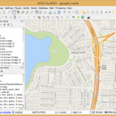
QGIS 3.36.1 freeware

QGIS supports vector, raster, and database formats and lets you browse and create map data on your computer.
QGIS supports many common spatial data formats (e.g. ESRI ShapeFile, geotiff). QGIS supports plugins to do things like display tracks from your GPS.
QGIS aims to be an easy to use GIS, providing common functions and features. The initial goal was to provide a GIS data viewer. ...

Author Gary Sherman
Released 2024-03-26
Filesize 1000.00 MB
Downloads 847
OS Windows XP, Windows Vista, Windows Vista x64, Windows 7, Windows 7 x64, Windows 8, Windows 8 x64, Windows 10, Windows 10 x64, Windows 11
Installation Instal And Uninstall
Keywords geographic information system, map creator, map viewer, GIS, geographic information, create, QGIS
Users' rating
(38 rating)
QGISCADWindows XP, Windows Vista, Windows Vista x64, Windows 7, Windows 7 x64, Windows 8, Windows 8 x64, Windows 10, Windows 10 x64, Windows 11
QGIS - layers Freeware Download Notice

QGIS Free Download - we do not host any QGIS torrent files or links of QGIS on rapidshare.com, depositfiles.com, megaupload.com etc. All QGIS download links are direct QGIS download from publisher site or their selected mirrors.

QGIS freeware - The Latest User Reviews
QGIS freeware - The Latest Versions History
3.36.1 Mar 26, 2024 New Release
3.36.2 Apr 25, 2024 New Release
3.36.1 Mar 26, 2024 New Release

Most popular CAD freeware downloads

JMARS

3.1.5 freeware download

... Contour maps may be created. * Groups of layers can be composed by transparency blending or building an HSV/RGB composite. * Plots may be created ...

5 freeware award

JMARS for Windows

3.1.5 freeware download

... Contour maps may be created. * Groups of layers can be composed by transparency blending or building an HSV/RGB composite. * Plots may be created ...

TNTmips for Mac OS X

20240111 freeware download

... price without costly add-ons. Precisely overlay geodata layers in a variety of data types and a multitude of Coordinate Reference Systems. Include layers in a wide variety of external formats without ...

GstarCAD MC

3.3.1 freeware download

... Scale, Color, Measure object, record management results, manage layers and use Layout. • Advanced drawing and editing tools such as trim, offset, dimension and find ...

CARIS Easy View

4.2.13 freeware download

... of files. It allows you to load multiple layers, change their order and adjust object parameters. View ... Users can also make selections and query 2D layers for additional analysis of the data. Using the ...

Elshayal Smart

23.02 freeware download

... files, build new layer, add existing layer, remove layers, swap layers, save layer, set layer data source, layer properties, ...

Mobile Atlas Creator for Mac OS X

2.2.1 freeware download

... u-blox and others Prepare atlases consisting of multiple layers, different map sources map resolutions (zoom levels)... Save ... atlas compilation as profile to/from file Merge different layers using Drag & Drop Create map tiles using ...

TNTmips

20240404 freeware download

... price without costly add-ons. Precisely overlay geodata layers in a variety of data types and a multitude of Coordinate Reference Systems. Include layers in a wide variety of external formats without ...

QGIS for Linux

3.36.1 freeware download

... analysis · On the fly projection of vector layers · Map composer · Identify features · Display attribute table · Select features · Label features ...

Mobile Atlas Creator

2.2.1 freeware download

... u-blox and others Prepare atlases consisting of multiple layers, different map sources map resolutions (zoom levels)... Save ... atlas compilation as profile to/from file Merge different layers using Drag & Drop Create map tiles using ...