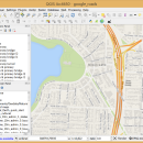
QGIS for Mac 3.36.1 freeware

... database formats and lets you browse and create map data on your computer.
QGIS supports many common spatial data formats (e.g. ESRI ShapeFile, geotiff). QGIS supports plugins to do things like display tracks from your GPS.
QGIS aims to be an easy to use GIS, providing common functions and features. The initial goal was to provide a GIS data viewer. ...

Author Gary Sherman
Released 2024-03-26
Filesize 1600.00 MB
Downloads 824
OS Mac OS X
Installation Instal And Uninstall
Keywords geographic information system, map creator, map viewer, GIS, geographic information, create, QGIS for Mac
Users' rating
(36 rating)
QGIS for MacCADMac OS X
QGIS for Mac - map Freeware Download Notice

QGIS for Mac Free Download - we do not host any QGIS for Mac torrent files or links of QGIS for Mac on rapidshare.com, depositfiles.com, megaupload.com etc. All QGIS for Mac download links are direct QGIS for Mac download from publisher site or their selected mirrors.

QGIS for Mac freeware - The Latest User Reviews
QGIS for Mac freeware - The Latest Versions History
3.36.1 Mar 26, 2024 New Release
3.36.2 Apr 25, 2024 New Release
3.36.1 Mar 26, 2024 New Release

Most popular CAD freeware downloads

Panoply for Mac

5.4.3 freeware download

... one plot by differencing, summing or averaging. Create map plots of trajectory data based on the CF ... Plot lon-lat data on a global or regional map using any of over 200 map projections or ...

JMARS

3.1.5 freeware download

... be created by drawing multi-segment lines on the map, making it easy to sample elevation, thermal inertia, ... common formats. * Edit vector data on the map or in a table. * Use vector processing ...

5 freeware award

Bifido Punnett Square Calculator Pro

3.4 freeware download

... it includes: Punnett Square Calculator Crossing Over Map Calculator Fruit Fly Sex Calculator Recombination Progeny Calculator ...

JMARS for Windows

3.1.5 freeware download

... be created by drawing multi-segment lines on the map, making it easy to sample elevation, thermal inertia, ... common formats. * Edit vector data on the map or in a table. * Use vector processing ...

GeoMapApp

3.7.1 freeware download

GeoMapApp is a map-based application for browsing, visualizing and analyzing a diverse ... Imported table values can be edited and the map symbol, color and size are adjustable. Tabular values ...

MagicPlot Student

2.9.3 freeware download

... - Data processing - Multiple axes - Color map plots - Figure templates - Batch processing ...

MagicPlot Student for Linux

2.9.3 freeware download

... - Data processing - Multiple axes - Color map plots - Figure templates - Batch processing ...

Doodles 3D

0.76 freeware download

... allows you to work with textures and to map them to certain model areas. You can save the points to a text file that can ...

Picard

2.27.2 freeware download

Picard comprises Java-based command-line utilities that manipulate SAM files, and a Java API (SAM-JDK) for creating new programs that read and write SAM files. Both SAM ...

CARIS Easy View

4.2.13 freeware download

CARIS Easy View is a simple application that enables you to view spatial data imported from numerous types of files. It allows you to load multiple ...