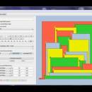
Maps coloring 1.9 freeware

Maps coloring is a small, easy to use, Java based application specially designed to help you find a very simple pencil and paper proof of the four color problem. ...

Author Mario Stefanutti
Released 2013-01-28
Filesize 8.10 MB
Downloads 353
OS Windows XP, Windows Vista, Windows Vista x64, Windows 7, Windows 7 x64, Mac OS X
Installation Instal And Uninstall
Keywords analyze four color problem, solve four color problem, pencil and paper proof, analysis, analyze, solve
Users' rating
(13 rating)
Maps coloringCADWindows XP, Windows Vista, Windows Vista x64, Windows 7, Windows 7 x64, Mac OS X
Maps coloring - maps Freeware Download Notice

Maps coloring Free Download - we do not host any Maps coloring torrent files or links of Maps coloring on rapidshare.com, depositfiles.com, megaupload.com etc. All Maps coloring download links are direct Maps coloring download from publisher site or their selected mirrors.

Maps coloring freeware - The Latest User Reviews
Maps coloring freeware - The Latest Versions History
1.9 Jan 28, 2013 New Release
1.8 Mar 28, 2012 New Release

Most popular CAD freeware downloads

Panoply for Mac

5.4.3 freeware download

... can project the analysis using more than 100 maps. What’s more, you get to overlay continent, or other types of masks on top of the ...

Mobile Atlas Creator for Mac OS X

2.2.1 freeware download

... applications please see the features section. Additionally individual maps can be exported as one large PNG image ... can use a large number of different online maps such as OpenStreetMap, Google Maps, Yahoo Maps and ...

Energy3D

8.4.5 freeware download

... a helidon that can dynamically generate radiation heat maps. Energy3D allows students to "print out" a design, cut out the pieces, and use ...

Gwyddion

2.66 freeware download

... color or material representation · easily editable color maps and OpenGL materials · basic operations: rotation, flipping, inversion, data arithmetic, crop, resampling · leveling: plane ...

Mobile Atlas Creator

2.2.1 freeware download

... applications please see the features section. Additionally individual maps can be exported as one large PNG image ... can use a large number of different online maps such as OpenStreetMap, Google Maps, Yahoo Maps and ...

GpsTools Studio

2.3.1 build 227 freeware download

... GpsGate Server users that want to create custom maps in order to use them for tracking the GPS devices. The program allows you to import ...

TNTatlas

2024 B20240606 freeware download

... viewer that lets you publish and distribute your maps and geospatial data — from a single geodata ... part in the way we work and live. Maps, drawings, photos and related materials may be the ...

JMARS for Windows

3.1.5 freeware download

... roughness data with thermal inertia data. * Contour maps may be created. * Groups of layers can ... THEMIS, Viking, and CTX; topography from MOLA; compositional maps from TES and GRS/HEND; albedo and thermal inertia ...

ArcReader

10.5.0 B6491 freeware download

... that allows users to view, explore, and print maps and globes. Anyone with ArcReader can view high-quality interactive maps authored by a high-level ArcGIS for Desktop product ...

TNTmips for Mac OS X

20240111 freeware download

... formats without importing. Overlay your geodata on Bing Maps imagery and maps or on geodata layers published on the Internet ...