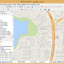
QGIS 3.36.1 freeware

QGIS supports vector, raster, and database formats and lets you browse and create map data on your computer.
QGIS supports many common spatial data formats (e.g. ESRI ShapeFile, geotiff). QGIS supports plugins to do things like display tracks from your GPS.
QGIS aims to be an easy to use GIS, providing common functions and features. The initial goal was to provide a GIS data viewer. ...

Author Gary Sherman
Released 2024-03-26
Filesize 1000.00 MB
Downloads 847
OS Windows XP, Windows Vista, Windows Vista x64, Windows 7, Windows 7 x64, Windows 8, Windows 8 x64, Windows 10, Windows 10 x64, Windows 11
Installation Instal And Uninstall
Keywords geographic information system, map creator, map viewer, GIS, geographic information, create, QGIS
Users' rating
(38 rating)
QGISCADWindows XP, Windows Vista, Windows Vista x64, Windows 7, Windows 7 x64, Windows 8, Windows 8 x64, Windows 10, Windows 10 x64, Windows 11
QGIS - vector software Freeware Download Notice

QGIS Free Download - we do not host any QGIS torrent files or links of QGIS on rapidshare.com, depositfiles.com, megaupload.com etc. All QGIS download links are direct QGIS download from publisher site or their selected mirrors.

QGIS freeware - The Latest User Reviews
QGIS freeware - The Latest Versions History
3.36.1 Mar 26, 2024 New Release
3.36.2 Apr 25, 2024 New Release
3.36.1 Mar 26, 2024 New Release

Most popular CAD freeware downloads

ShareCAD

2.0 freeware download

... CAD formats: AutoCAD DWG, DXF, DWF, HPGL, PLT; Vector formats: PDF, SVG, EMF, WMF, CGM; 3D formats: ... formats in any browser without installing any additional software; - zoom and rotate images, change display modes ...

VEGA ZZ

3.2.3.28 freeware download

... to make your research jobs very easy. This software is FREE for non-profit academic uses. Extreme ... and PDBQT multi-model formats. Snapshot, hardware and software image rendering with the capability to create images ...

CARIS Easy View

4.2.13 freeware download

... of file types without the need for specialized software. CARIS Easy View gives users control of ... Users can load multiple raster, point cloud and vector data sources, change the order in which they ...

QGIS for Linux

3.36.1 freeware download

... proud to be itself Free and Open Source Software (FOSS). QGIS supports vector, raster, and database formats and lets you browse ... needs. QGIS supports a number of raster and vector data formats, with new support easily added using ...

Geneious Basic x64

6.0.4 freeware download

Geneious is a useful, unique and easy-to-use software system which has been designed to greatly speed ... FASTA and Endnote formats. Import PDF, 3D Structures, Vector NTI, Chromatograms, DNA Strider, Clustal, list of formats ...

SketchEl

1.60 freeware download

... scaling. Molecules can be exported as SVG (Scalable Vector Graphics) pictures for external use. More recently, pictures can be exported as ODG (OpenDocument Graphics) pictures, ...

CyFluxViz

0.92 freeware download

CyFluxViz is an open-source Cytoscape plugin for the visualization of flux distributions in molecular interaction networks available for download at homepage The new release of ...

TNTmips for Mac OS X

20240111 freeware download

... that integrates imagery along with geometric data including vector, CAD, shape, pinmap, and TIN formats. Maintain relational database attributes for vector, CAD, and shape layers. The Job Processing ...

Thuban for Windows

1.2.2 freeware download

... Data Viewer with the following features: # Vector Data Support: Shapefile, PostGIS Layer and OGR # ... and Joins # Projection Support # Printing and Vector Export # API for Add-Ons (Extensions) # Multi-Language ...

TNTmips

20240404 freeware download

TNTmips software is a complete Geographic Information System (GIS) that ... that integrates imagery along with geometric data including vector, CAD, shape, pinmap, and TIN formats. Maintain relational ...